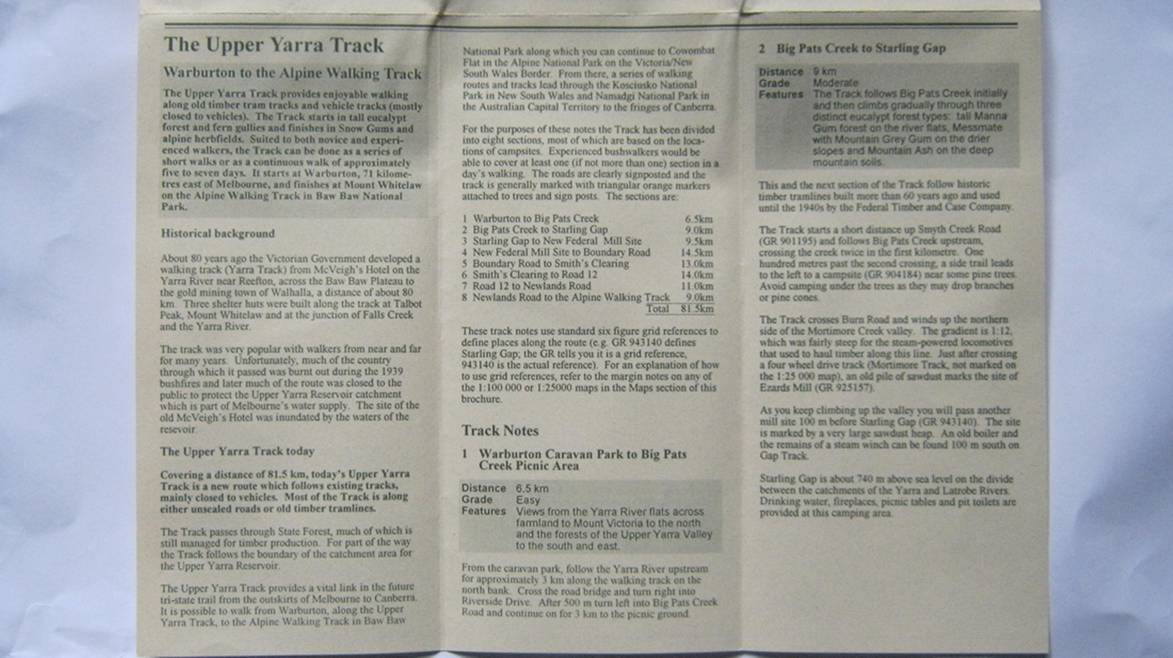
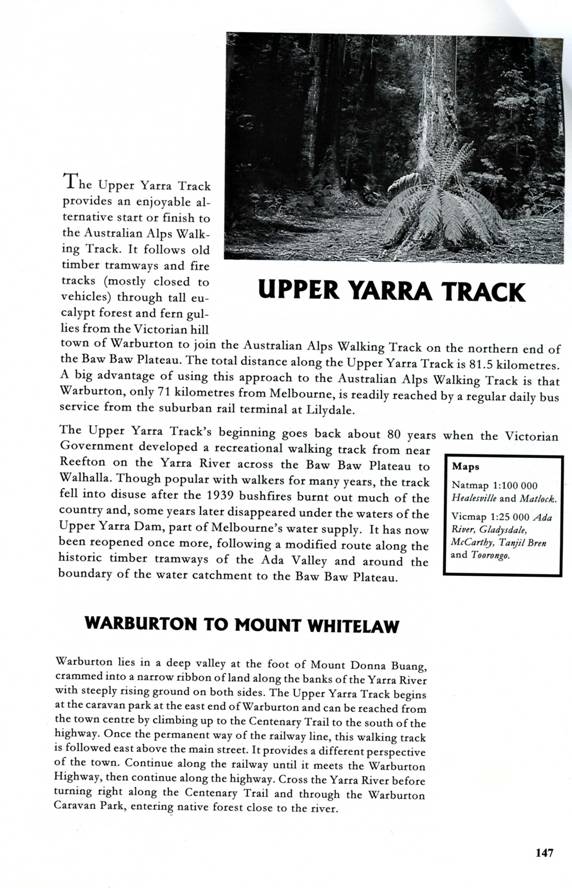
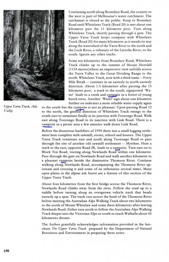
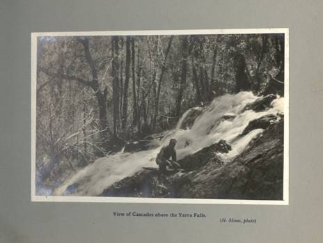
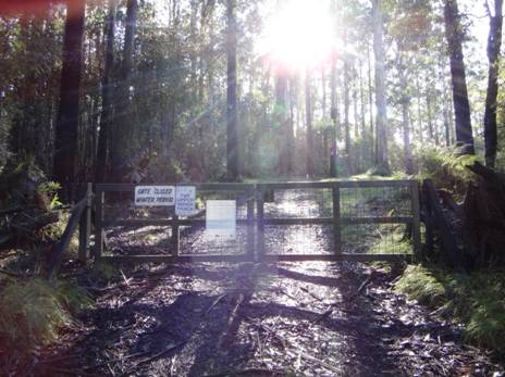
Upper Yarra Track Instructions
See also:
NEW
![]()
![]()
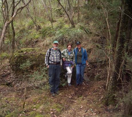
I am working on these instructions. (Who am I: http://www.theultralighthiker.com/about/) In time they will be complete. As of today 26/11/2015, they are good enough to get you all the way, but they will be better. Today, (17/11/2015) I have completed the first section: Moe-Yallourn North. Today 23/11/2015 I have completed the next two sections: Yallourn to Wirilda and Wirilda to Moondarra. 24/11/2015: completed Moondarra to Erica where the Erica-Walhalla Rail Trail begins: you can’t go wrong on the section to Walhalla fro Erica: approx 3-4 hours water 1/3 and 2/3 of the way (and more). That gets you to Walhalla. I am writing the instructions in the direction from Moe to Lilydale first because I live nearer this end. You can work backwards for the opposite direction. I will provide those notes when I have finished these ones. Winter Route (or fishing route - avoiding the Baw Baw Plateau), see Bottom of Page. Scroll down to see all instructions:
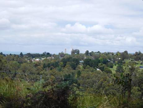
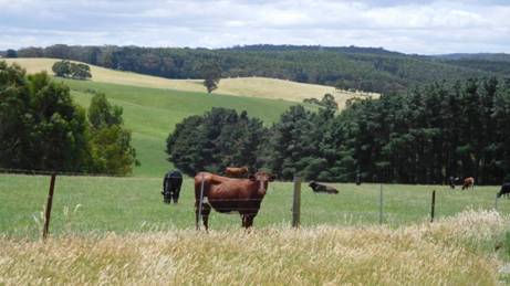
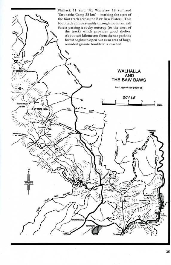
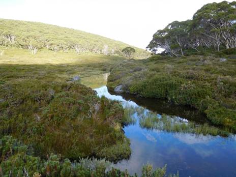
14/03/2017: Upper Yarra Track Map: Here is a map showing the whole of the (Extended) Upper Yarra Track
from Lilydale all the way to Moe, approximately 250 km and 8-10 days:
NB: Supplies: Rawson has intermediate
supplies near the track with a small Mini Mart. (Also a hotel in the caravan
park). You can loop by Rawson on your way to/from Walhalla or O’Shea’s Mill if you
need resupply. There is a licenced Foodworks in Yallourn North & small
licenced supermarket in Tyers (4.5 km off track), general store/hotel in Erica,
Walhalla and Noojee (very large detour), some supplies 7 days ( &
restaurant weekends – 3 days) and lots of accommodation at Mt Baw Baw (<5 km
off track) www.mountbawbaw.com.au
; winter supplies at Tanjil Bren and accommodation eg the Moosehead Lodge http://www.mooseheadlodge.com.au/
who especially cater for groups. (There are many lovely walks around Tanjil
Bren. If you never go anywhere else in the world (or
Transport: I will also doing a post soon about public transport to the track. For example, there is a regular weekday bus service to Noojee (about halfway – you can walk up to the track from there eg Ridge Road with a detour to Torongo Falls - I WILL do a route soon), http://www.warragulbuslines.com.au/Timetables.htm#4 and a very regular bus service Moe-Yallourn North – Tyers - Traralgon which gets you within an hour of the beginning of the Wirilda Track (saving approx 6.5 hours – the bus driver might be persuaded to stop at the Wirilda turn-off = 1 km; there are not likely to be many folks on it anyway) and obviously there are almost hourly trains/trams to Moe, Warburton and Lilydale. Mountain Top Experience can provide a bus service to/from (eg Moe) to eg Walhalla/Mushroom Rocks Car Park or wherever you want to go (price dependent on group size), for those who might wish to shorten the trip a bit: http://www.mountaintopexperience.com/tours/ They run a ‘regular’ bus service to Mt Baw Baw during the ski season.
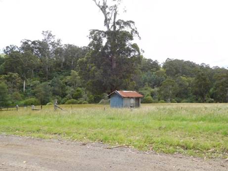
Accommodation: Mostly I anticipate you will want to camp outdoors but there are many spots along the way which offer paid accommodation, including: Yallourn North, Erica, Walhalla, Rawson, Mushroom Rocks, Caringal, Mt Baw Baw, Tanjil Bren, Noojee…
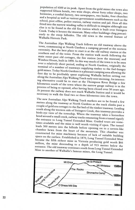
Total Distances (Approximate): Lilydale to Warburton 38km, Warburton to Mt Whitelaw 81.5km, Mt Whitelaw to Walhalla 43.5-49 (?) km, Walhalla to Moe 71 km. Total @ 250 km. Time 10-14 days?
See also: http://www.finnsheep.com/THE%20UPPER%20YARRA%20WALKING%20TRACK.htm
http://www.theultralighthiker.com/upper-yarra-track-update-section-one-moe-yallourn-rail-trail/
http://www.theultralighthiker.com/upper-yarra-track-update-section-three-wirilda-to-moondarra/
23/11/2015: Upper Yarra Track: Cumulative distances/Times: One-way only so far (sorry): Moe to Lilydale:

NB: This is a summary. These are ‘retiree’ walking speeds. The distances are approximate. You may do the trip much faster, but what’s the hurry? Moe-Walhalla will take 2-4 days. If you are young and fit you should be able to ride it on a mountain bike in about a day (approx 70km). There are many other spots you can obtain water or camp. Find them in the detailed track notes (as I add them) NB. You can shorten the trip by catching a bus to Tyers/Yallourn North, or to Noojee, or to Mt Baw Baw (winter only). Recommended App: Avenza Pdf Maps plus the maps below:
MAPS: Rooftop’s Walhalla-Woods Point &
Yarra Valley-West Gippsland Adventure Maps. 25K Downloadable Vicmaps http://services.land.vic.gov.au/maps/topo30maps.jsp
: Neerim North 25k_T8022-2-N, Noojee
North 25k_T8122-3-N, Walhalla North 25k_T8122-2-N & Walhalla South
25k_T8122-2-S Moe North 25k_T 8121-1-N, Moe South 25k_T 8121-1-S plus the
Android/Iphone App ‘Avenza Pdf Maps’ from Google Play Store.
Maps: Moe South Map T 8121-1-S:
Moe – Yallourn North (Water, Supplies, Camp) : 10 km – 2.5 hours
Yallourn North-Wirilda (Water, Supplies, Camp): 15 km 3.5-4 hours ( 25 km -5 hours)
Maps: Moe South Map T 8121-1-S to Moe North
T8121-1-N
Wirilda – W3 (Water, Camp): 7 km 2.5 hours (32 km - 7.5 hours)
W3 – Moondarra (Water, Camp): – 7 km 3 hours (39 km - 10 hours)
Moondarra – Jacob’s Creek (Water, Camp): 11 km - 3 hours (50 km - 13 hours)
Maps: Moe North T8121-1-N to Walhalls South T8122-2-S
Jacob’s creek – Erica (Water, Supplies, Camp): 9 km – 2.5 hours (59 km - 15.5 hours)
Erica – Thomson Station (Water): 8 km – 2 hours (67 km - 17.5 hours)
Thomson Station – Walhalla (Water, Supplies, Camp): 4 km – 1 hour (71 km - 18.5 hours)
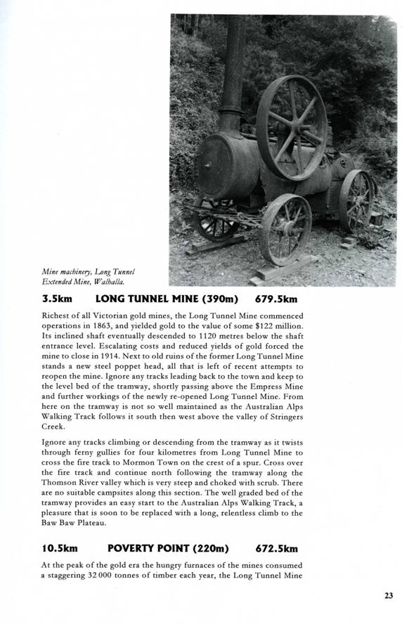
Walhalla – Poverty Point (Water): 7-8 km – 2-3 hours (79 km - 21 hours)
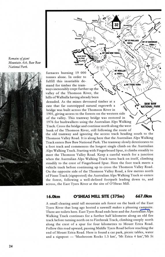
Poverty Point – O’Shea’s Mill (Water, Camp): 6 km – 2-3 hours (85 km - 24 hours)
O’Shea’s Mill to Mushroom Rocks Car Park (Water): 6-7 km- 2-3 hours (92 km - 27 hours) Walhalla South Map
Mushroom Rocks Car Park to
Maps: Walhalls South T8122-2-S to Walhalla
Talhousie Glen - Whitelaw’s Hut Site (Water, Camp): 9 km- 3-4 hours (111 km - 36 hours)
Maps: Walhalla North T8122-2-N to Noojee North
T8122-3-N
Whitelaw’s Hut – Frangipani Saddle: 7 km - 2 hours (118 km - 38 hours) Add .5 hours to (Water, Camp)
Frangipani saddle -
Newlands Rd Camp to Toorongo Link Junction (Water, Camp): 9 km – 2-3 hours (134 km - 43 hours)
Toorongo (Link Junction) – Hill 956 (Falls): 7 km – 2 hours (141 km - 45 hours)
(Falls Return: 4 km – 4 hours)
Hill 956 – Fire Suppression Stream (3 x Water Camp) : 3 km - 1 hour (144 km - 46 hours)
(Fire
Suppression Stream to Noojee = Water, Supplies, Camp @ 24 km – 6-8 hours = 54
hours =toMoe/30.5 =to Warburton. I will add intermediate route/water/camp
points in to this short-cut later)
Suppression Stream - Mt Horsefall (Camp): 6 km - 2 hours (150 km - 48 hours)
(Mt Horesfall- Penny falls (Water Camp) 1 km - .5 hour each way)
Mt Horsefall - Davis No 2 Mill Site (Water): 4.5 – 1.5 hours ( 154.5 km - 49.5 hours)
Maps: Noojee North T8122-3-N to Neerim North TT8022-2-N:
Davis No 2 Mill Site - 7.5 North Loch Rd– 2 hours (162 km - 51.5 hours) (+1 km each way to (Water, Camp)
Maps: Neerim North TT8022-2-N:
North Loch Rd – Fire Dam (1 Km North of Track 14 near Hill 697 – Water, Camp) 9.5 km – 2.5 – 3 hours (171.5 km - 54.5 hours)
Fire dam –Mc Carthy Spur Track 8 km – 2 hours (179.5 km - 56.5 hours)
McCarthy Spur - Lashos Corner (Water.5 km South) : 6 km - 2 hours (185.5 km - 58.5 hours)
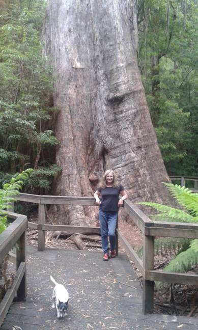
Lashos Corner - Ada Tree (Water, Camp): 5 km -1.5 hours (193.5 km - 60 hours)
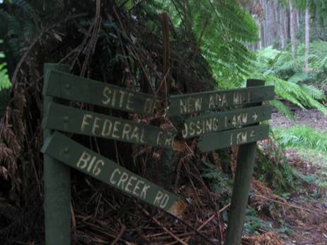
Starlings Gap to Big Pats Picnic Area (Water): 9 km – 3.5 hours (210.5 km - 66.5 hours)
Big Pats Picnic Area – Warburton (Water, Supplies, Camp): 6-7 km – 2 hours (217.5 km - 68.5 hours)
Warburton – Lilydale (Water, Supplies, Camp) 40 km – 10 hours (247.5 km 2 80 hours) See: http://www.yarraranges.vic.gov.au/Lists/Parks-Facilities/Lilydale-to-Warburton-Rail-Trail
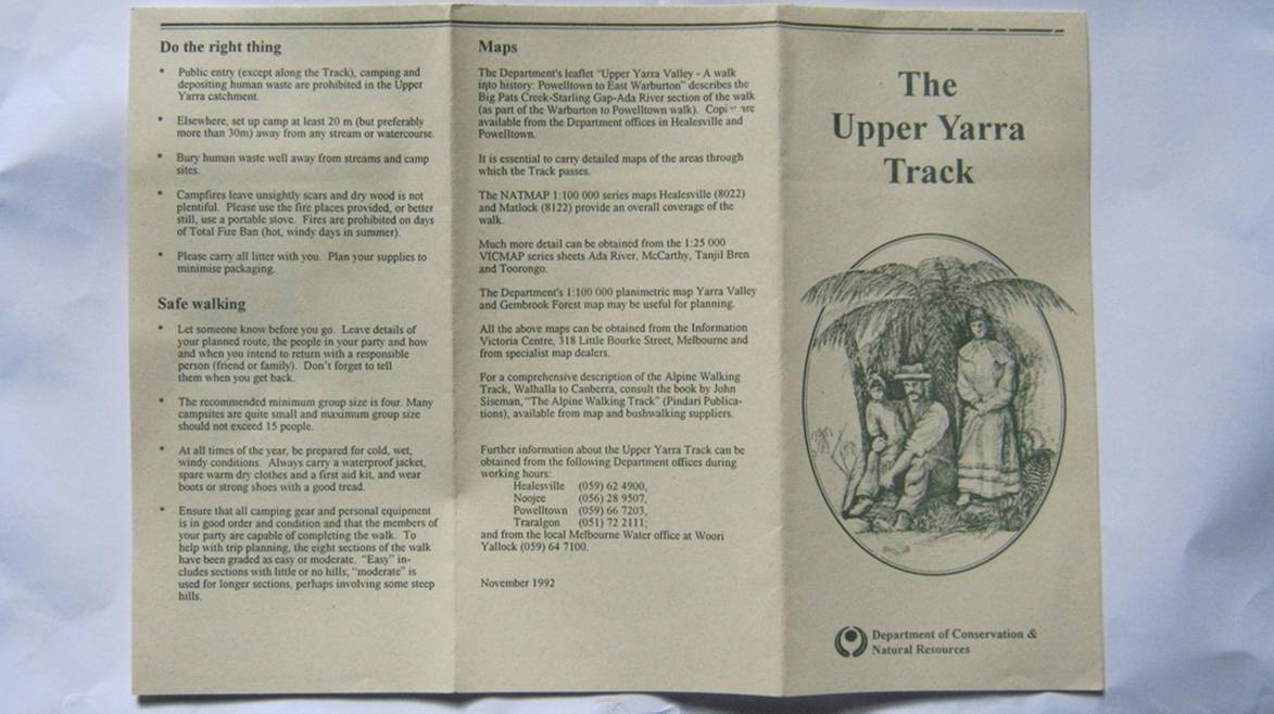
Old DCNR Brochure
(Courtesy Thomas Osburg)
1907 Map &
Instructions:
Inset Detail:

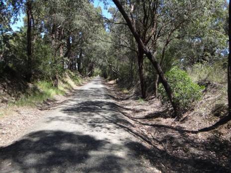
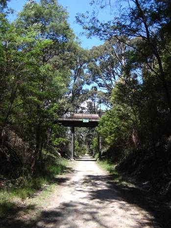
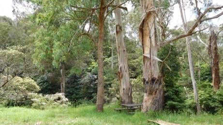
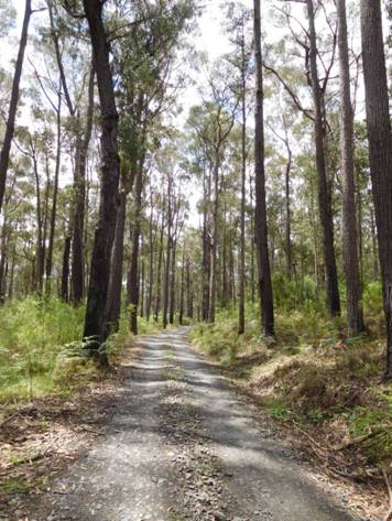
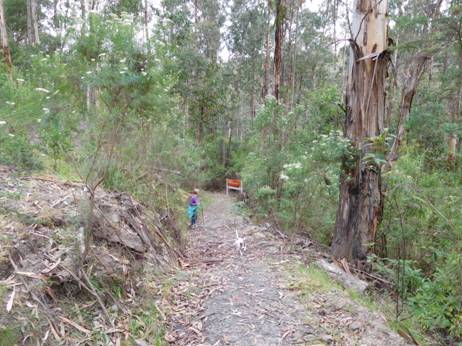
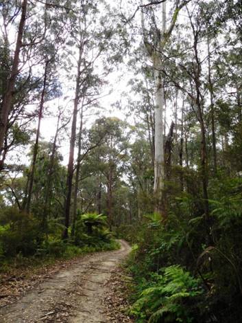
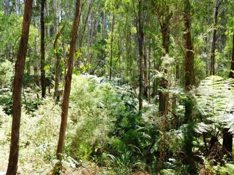
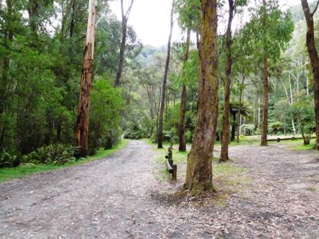
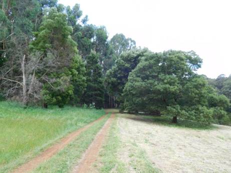
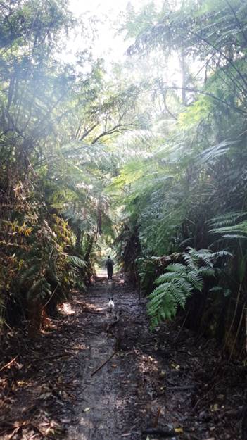
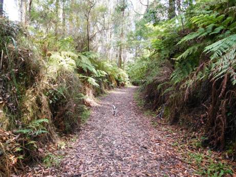
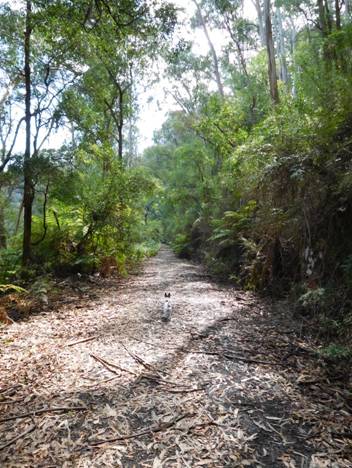
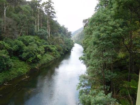
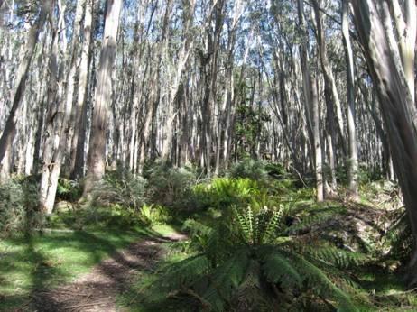
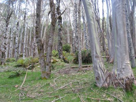
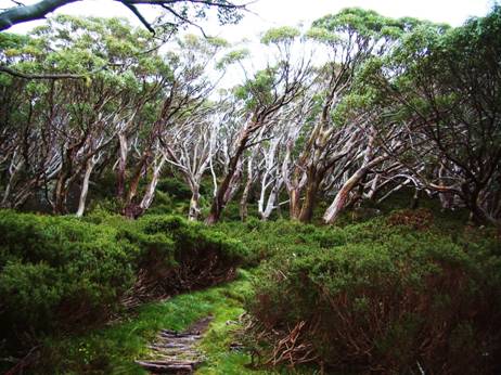
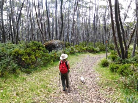
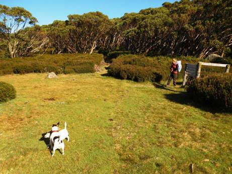
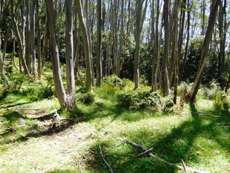
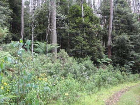
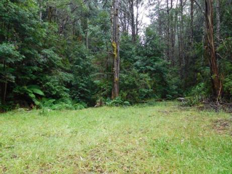
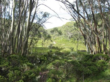
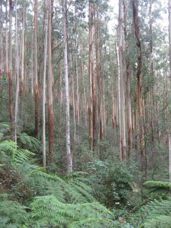
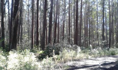
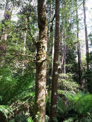
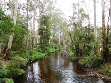
The Moe-Yallourn Rail Trail is a great
intro to Gippsland hiking. There are no signs at either of its ends! We spent
some time yesterday exploring…300 metres East of Moe Railway Station you start
on this trail (a little gravel track at the corner of Bennett St & Narracan
Drive (50 metres east of that awful roundabout/railway bridge overpass). Why
the trail has been allowed to overgrow UNDER that bridge IS a mystery: the old
line clearly continues to the station car park, but…Latrobe Shire!). You set
foot on it, and suddenly you are in the country (including sheep within 300
metres of Moe railway station). 8.5 km later you exit it amid a park full of
ancient pine trees (perhaps even planted by Monash himself, who knows?) close
on the
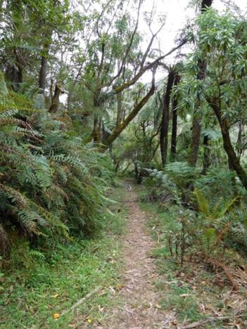
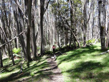
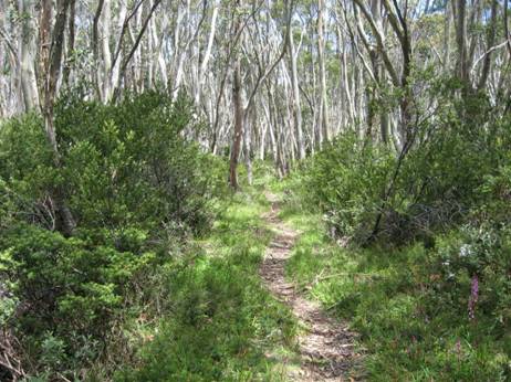
Upper Yarra Track Section One: Moe-Yallourn Rail Trail:
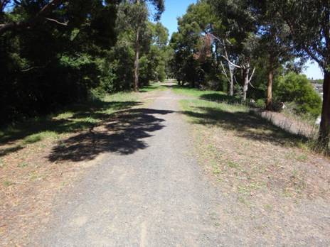
The trail begins...
This lovely @ 8km (2 hour) trail starts @ 200 metres East of Moe Railway Station (just past the two railway bridges you can see from the station) at the corner of Narracan Drive & Bennett St.
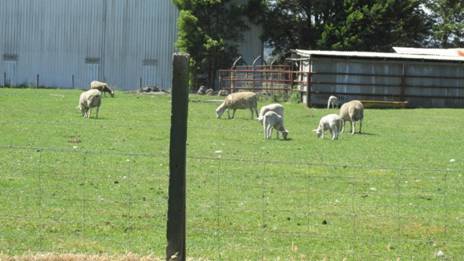
Wiltshire Horn ewes and lambs no more than 200 metres from Moe Railway Station.
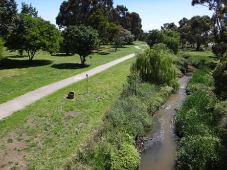
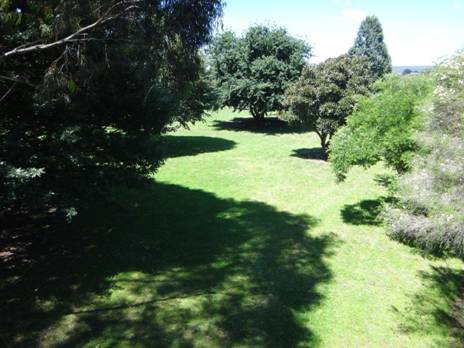
Within 100 metres you are in another world. On the right are the beautiful Moe Botanic Gardens; on the left a small paddock full of sheep – which is extraordinary.
Moe is a large country town (pop 15,000) a little over 1 hour by train with services approx hourly. You will be able to see a large Woolworths Supermarket on your left as you come up to the railway bridges. The shopping centre has at least one other supermarket and many other shops. The Botanic Gardens nestled along pretty Narracan Creek are worthy of a little exploration before you head off towards Walhalla. Then, on to the rail trail.
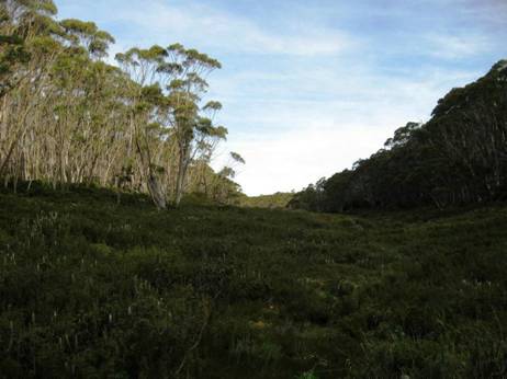
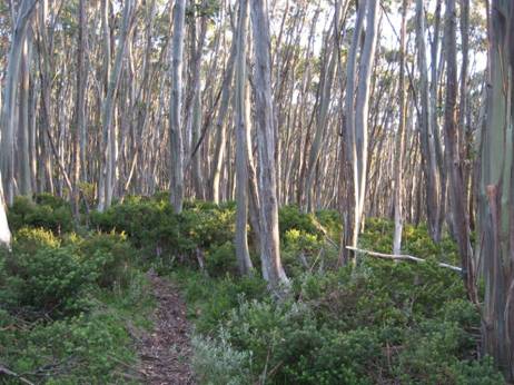
Being an old railway line it is obviously dead flat all the
way to the Yallourn Power Station on the beautiful
Obviously there are toilets and water at the Railway Station before you set out, again in Sullivans Rd halfway to Yallourn PS (signposted), then at the picnic area behind it (signposted on the Yallourn North Rd Bridge crossing), and finally in the main street of Yallourn North.
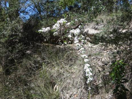
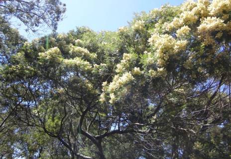
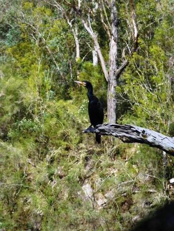
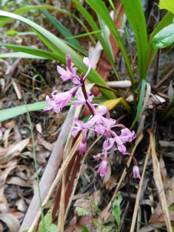
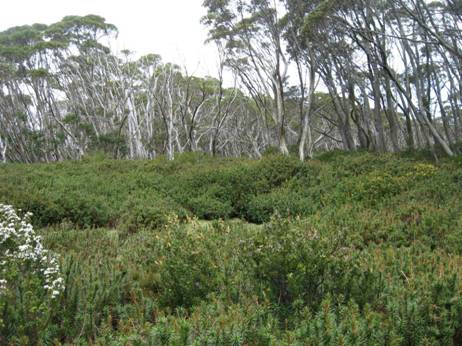
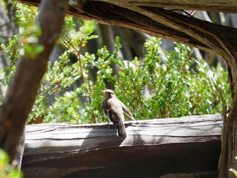
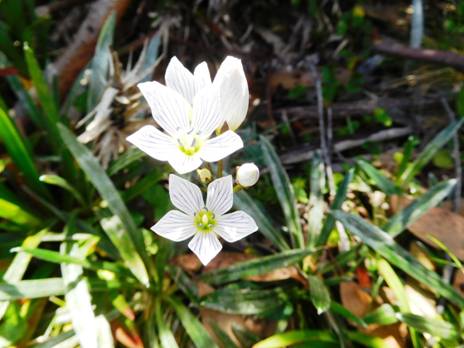
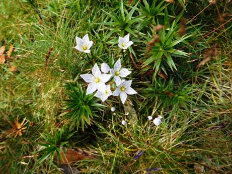
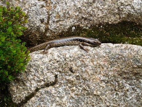
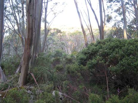
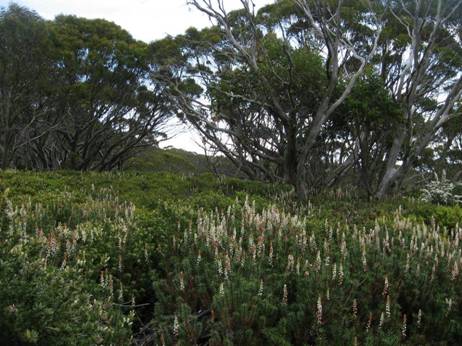
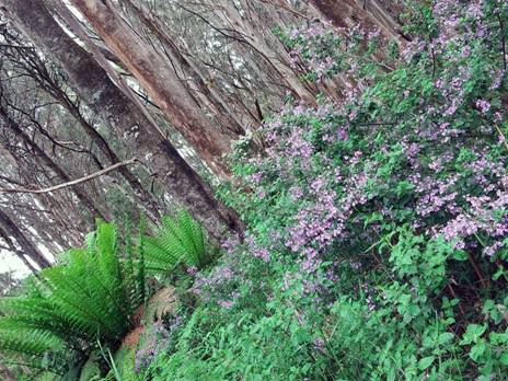
The sights are varied. Surprisingly for almost the entire length of the walk to the power station you are enclosed in a curtain of native vegetation (of varying width) with abundant wildlife (birdlife especially). There are always some beautiful wildflowers in bloom.
Wattle Bird
Currawong
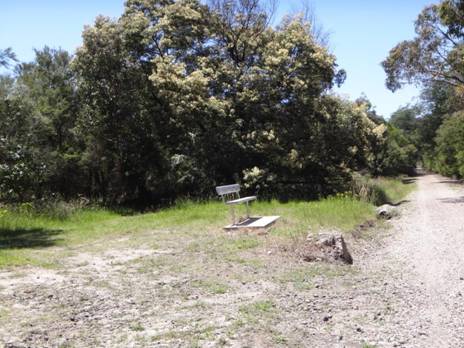
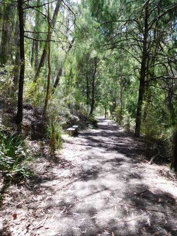
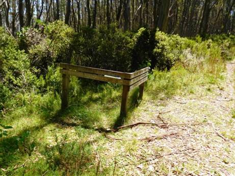
The concrete foundations of the old railway telegraph poles make excellent seats every 50 metres or so. Just great for a picnic lunch – perhaps a sandwich and a glass of wine bought back before leaving Moe. Here and there park benches are thoughtfully provided as well. The track has distance markers (which can be used as references for making emergency calls). Telstra NextG works fine the full length of this section.
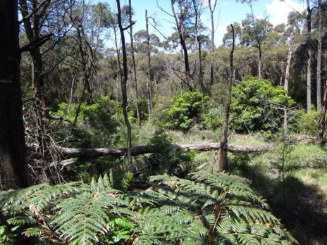
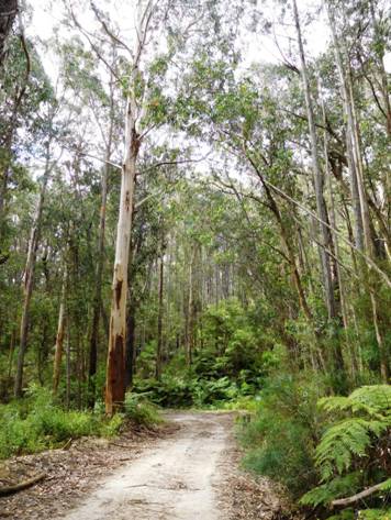
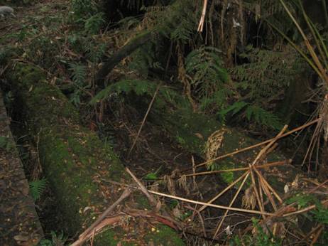
In places the trail is fringed with forest.
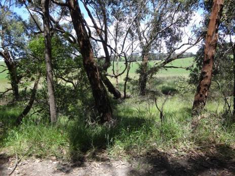
Often there are glimpses of distant paddocks or beautiful
I see no reason you could not camp along the sides of the track (there are little flat spots here and there a tent could be erected), or along the banks of the Latrobe or in Sir John Monash Reserve. You would have to carry any water needed to them.
At
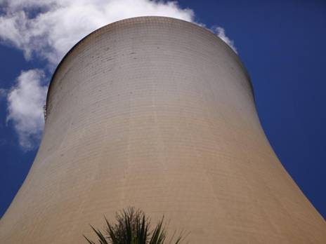
The cooling towers are great works of art.
The diversion is worth it, what you are seeing is the lower reaches of Lake Narracan sometimes glimpsed earlier through the trees to the North, but it is also worth backtracking along the ‘proper’ route when you get there a bit and viewing the wonderful towers through the frame of the underneath of the Yallourn North Road Bridge.
Sir John Monash Reserve
From the ancient pines of Sir John Monash Reserve you can
continue along 3-400 metres of riverbank track to the
Next stop:
Announcing The
I will also be doing a post soon about public transport to the track. For example, there is a regular weekday bus service to Noojee (about halfway), http://www.warragulbuslines.com.au/Timetables.htm#4 and obviously there are almost hourly trains/trams to Moe, Warburton and Lilydale. Mountain Top Experience provides a bus service from (eg Moe) to eg Walhalla/Mushroom Rocks Car Park etc, for those who might wish to shorten the trip a bit: http://www.mountaintopexperience.com/tours/
Upper Yarra Track Update: Section Two: Yallourn North
to
(@15 km – 3.5-4 hours)
Yallourn North nestled in its hills.
Latrobe Valley Bus Lines run regularly to
Yallourn North and Tyers townships: http://ptv.vic.gov.au/route/view/8366
This can save you nearly a day’s walk if you are pressed for time. Enquire if
the bus will stop at
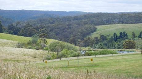
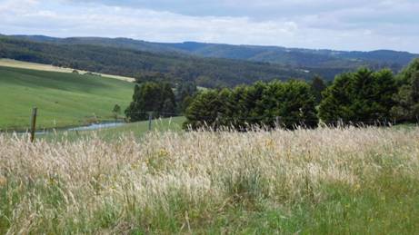
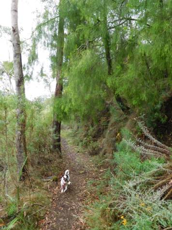
This section is easy going along quiet
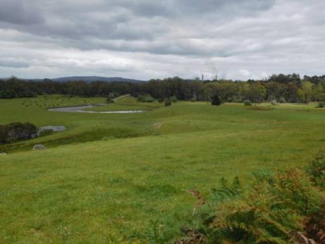
country lanes with lovely vistas and ample shady spots if you need a roadside
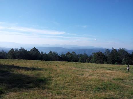
rest to enjoy the view. You look out Southwards over the verdant
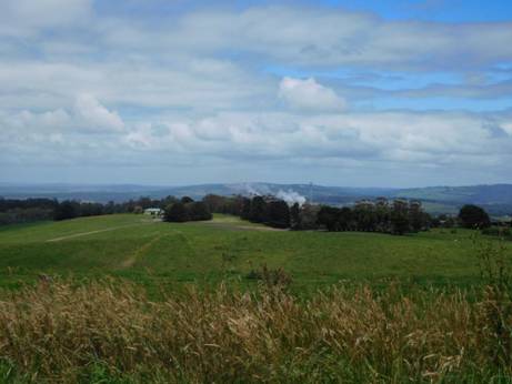
Looking Back at Yallourn Power Station
Australian Paper refinery Maryvale; Strzelecki Ranges Beyond.
(There are also many great walks at Wilsons Prom http://parkweb.vic.gov.au/explore/parks/wilsons-promontory-national-park/things-to-do/southern-prom-overnight-hikes and just across the valley is the Grand Strzelecki Track with over 100 kms of trails: http://www.tourismwellington.com.au/balook-tarra-bulga/attractions/item/grand-strzelecki-walking-track .)
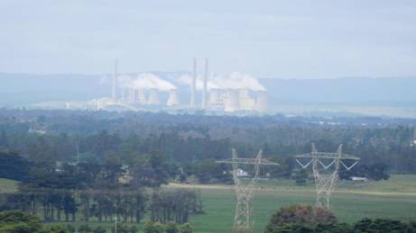
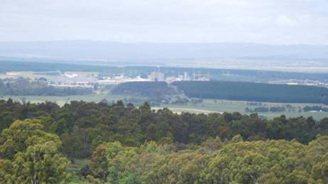
Loy Yang Power station, Strzelecki Ranges Beyond
Once you leave the licenced Foodworks
Supermarket, walk up the hill to your West (3/4km) and turn North down
Anderson Creek.
¾ km along Murray Rd you cross the very pretty Anderson Creek which is your last water for the next 12.5 km (3 hours) except for numerous beautiful dams in farmer’s paddocks (beware bulls if you need to jump a fence on a hot day!)
When you reach
Follow
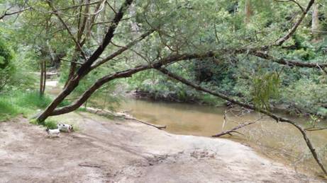
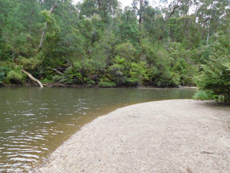
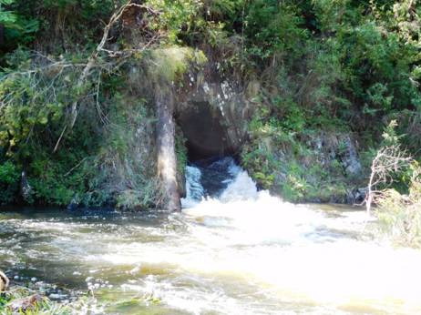
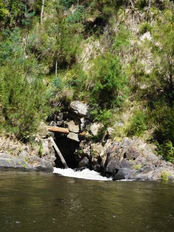
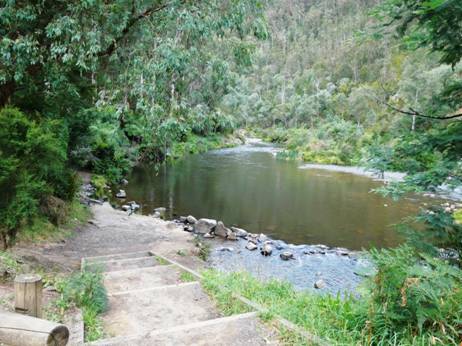
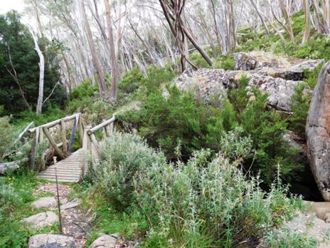
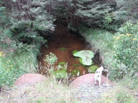
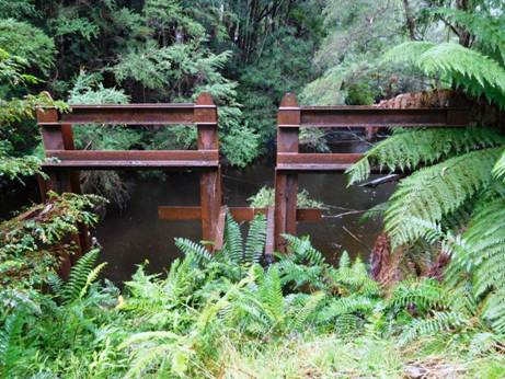
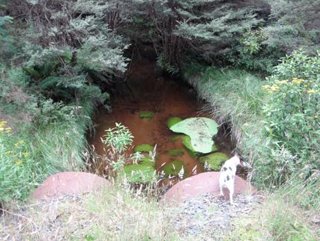
From there it is about ¾ km to lovely shady flat campsites along the river near the weir (great swimming hole in hot weather). Toilets, seats and water available. The Wirilda Track begins here and is clearly signposted next to the Morwell Pumping Station building.
Above & Below: Wirilda park - a lovely spot to camp.
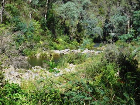
You may happen to stay a few days at Wirilda: there are innumerable bush tracks and swimming holes to explore. The river abounds with trout, blackfish, spinyback crays (and unfortunately European carp) so a fishing licence is recommended.
Above & Below:
It is 4.5 km walk East in to the
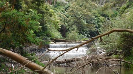
Weir at Wirilda - a great swimming hole.
See also:
http://www.finnsheep.com/THE%20UPPER%20YARRA%20WALKING%20TRACK.htm
http://www.theultralighthiker.com/upper-yarra-track-update-section-one-moe-yallourn-rail-trail/
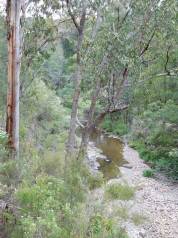
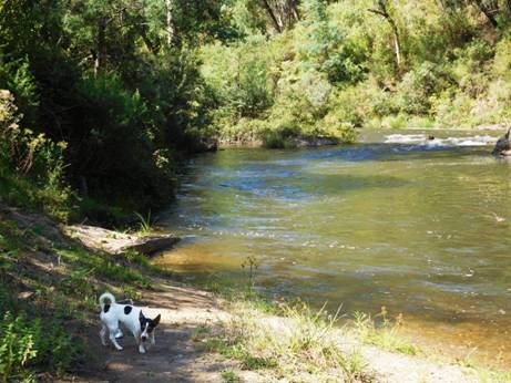
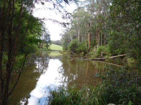
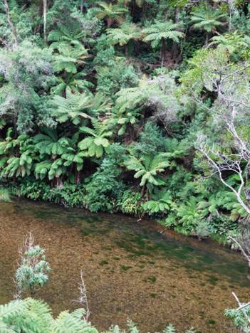
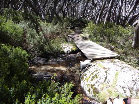
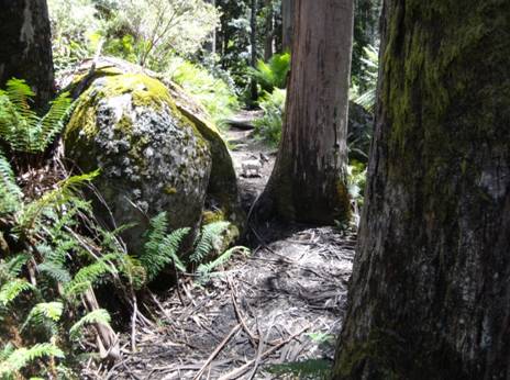
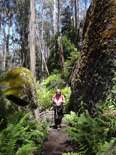
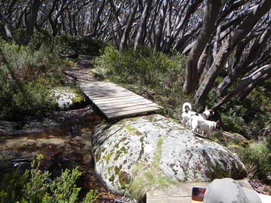
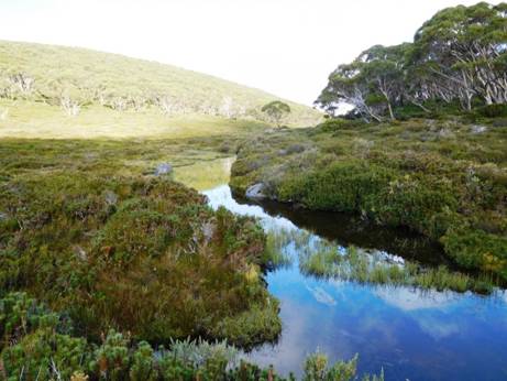
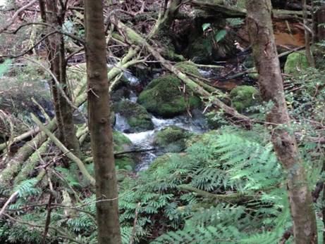
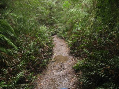
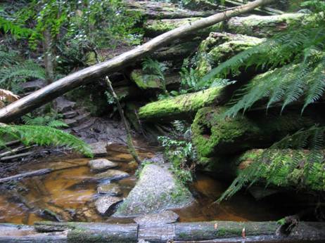
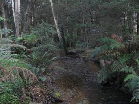
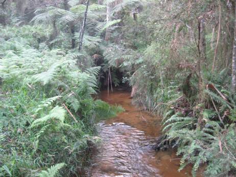
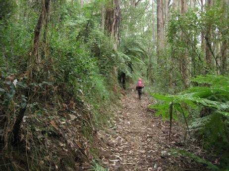
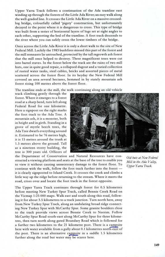
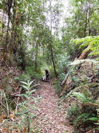
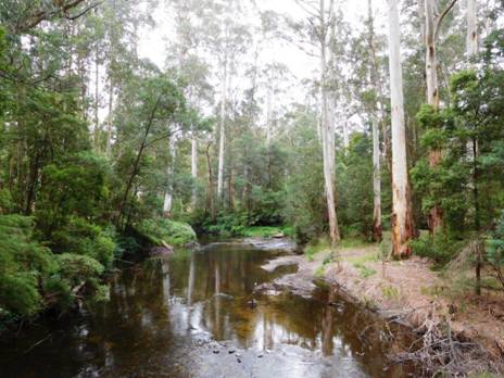
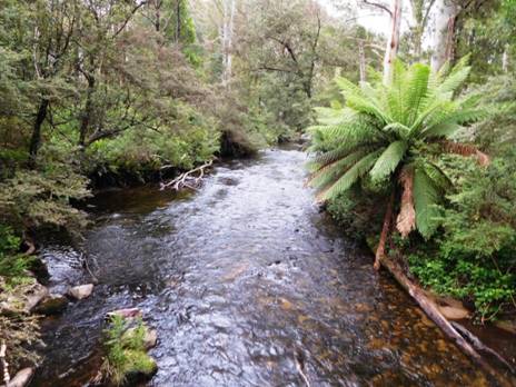
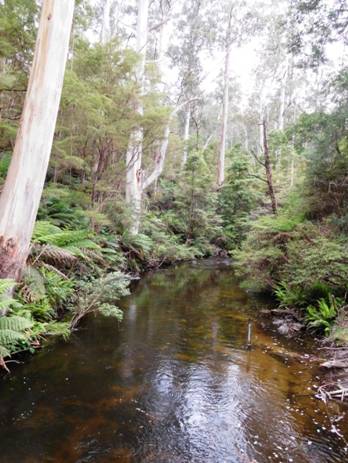
Upper Yarra Track Update: Section Three: Wirilda to Moondarra
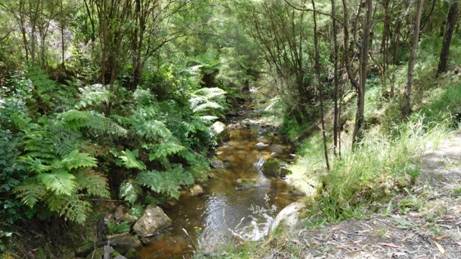
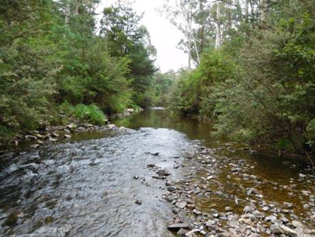
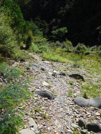
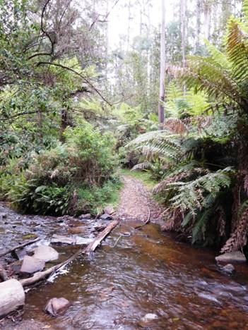
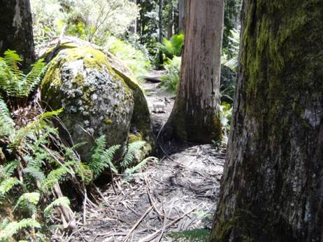
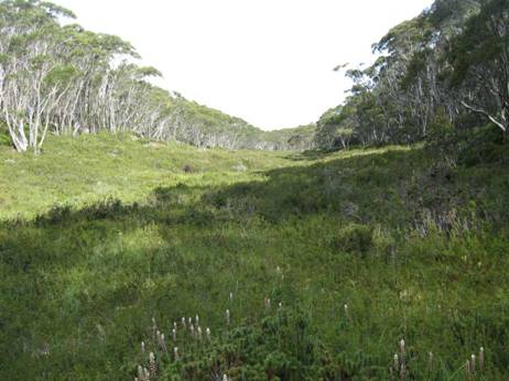
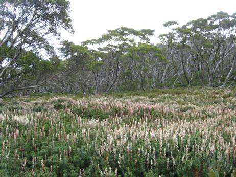
(@15 km – 6 hours) The track follows the true right bank (ie facing downstream) of the Tyers river until it crosses on an old pipeline. There are numerous spots where you could stop for a picnic, overnight or for a fish.

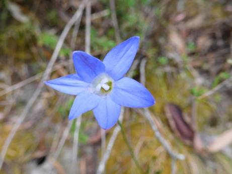
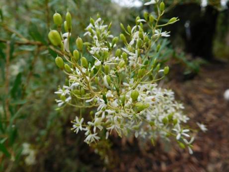
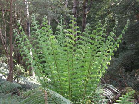
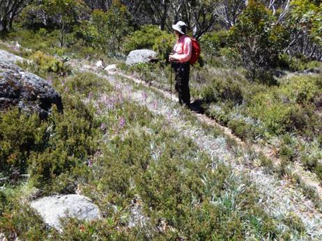
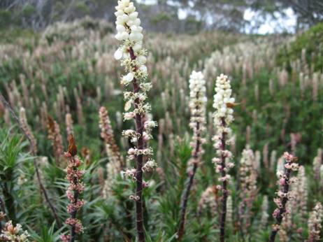
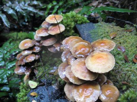
There are many beautiful wildflowers.
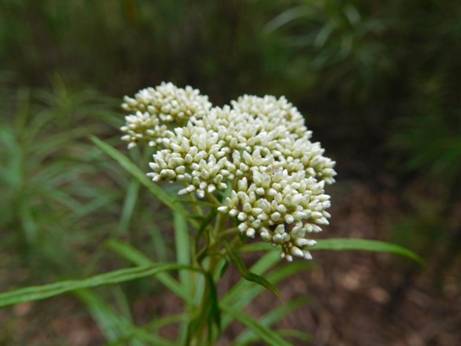
I usually don't like dogwood, but it has its beauties...
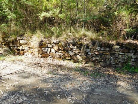
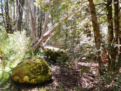
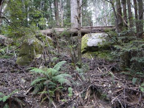
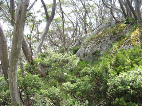
The impressive cliffs below Peterson’s lookout are a feature. Birdlife, wildlife and wild flowers abound. There are a number of side tracks which can be explored. Keep your eye out for signs of the old pipelines one of which was made of wood!
Old wooden water supply pipe.
Parks Victoria reckon this section to be 18 km and to take 5-7 hours (see brochure) http://parkweb.vic.gov.au/__data/assets/pdf_file/0010/315766/Park-note-Tyers-Park.pdf
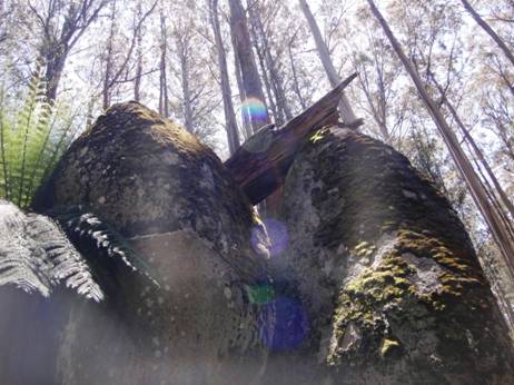
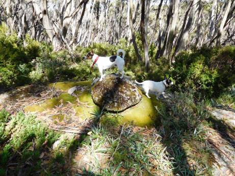
Giant Tor along the way: wouldn't have want to be around when the Titans were playing marbles with these guys!
Pipeline crossing just South of w3 track.
Park notes: ‘The open forests are dominated
by Yertchuk and Silvertop, with an understorey of wattles, tea trees, sedges
and grasses. Along the ridges, an open
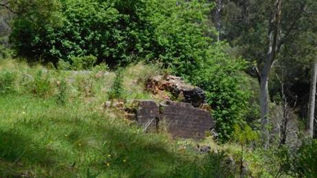
Figure 1Old lime kilns on W3 track.
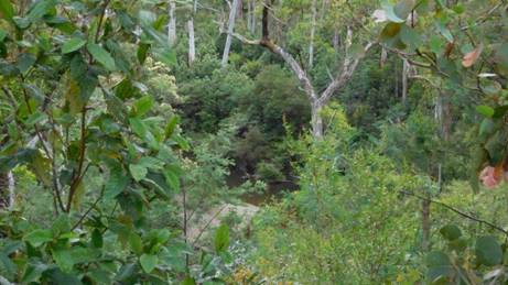
Frequent glimpses of the river.
Rock face just right for climbing.
It is approximately 2- 2.5 hours to two
splendid camps on the W3 track. The first may need you to carry water 15
minutes from the pipeline crossing point (sometimes just under water) just
below the W3. At the second camp where the old limestone kilns and some ancient
apple trees can still be seen, water can easily be obtained from the river (100
metres). The cliff face opposite the kilns is popular for rock climbing
practice. Don’t! An alternative more private camp can be found earlier by turning
towards and passing through the locked gate when you hit the W3 track, approx a
further 1km along past it. Water is available from the river. There are many
miles of locked roads in the
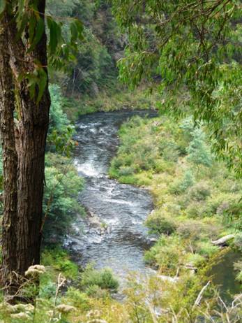
It is a lovely little river.
So many pretty stretches.
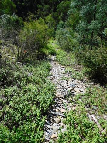
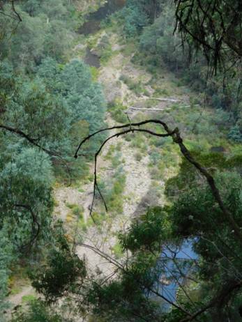
The track descends from the W3 to Whites creek (water) then contours through fern groves until it meets a 4WD track which joins the W12. You follow the W12 downhill to the river. There is a camp 45 minutes along the track from the W3 just off the W12 track .5 km South of the bridge Just before you get to it you may notice another old picturesque water supply weir in the river. From the W12 track it is approx 2 hours to the W18 track (Moondarra).
The river is canoeable, but some places you can get stuck.
The river is canoeable for a very long way…You
can probably start at Christmas Creek on the
A diverse range of different trees.
Camping on the many sandbars is an option.
The trout were rising here: fresh fish for supper!
After you leave the W12 the track crosses a minor stream (water) then zig zags upwards away from the river until it meets a 4WD track (the W18.2) which it follows for about a km, then it descends fairly steeply to the river once more. The track follows the river for the last kilometre or so and is mostly only 10-20 metres from it. You can be looking out for a spot along here to put up a small tent (even in the middle of the track would be fine); lots of spots. You can camp just before the Moondarra end of the track., just before the spillway viewing area (keep an eye out for it) , or near the bridge over the small stream about 200 metres from the W18 Track. The next good camp with water is about 3 hours further on…
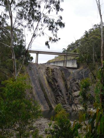
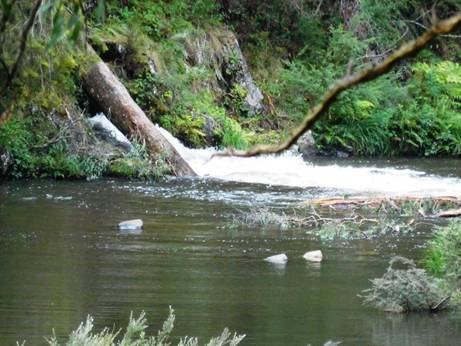
Spillway from viewing area approx 300 metres from the end of this section.
View downstream from spillway.
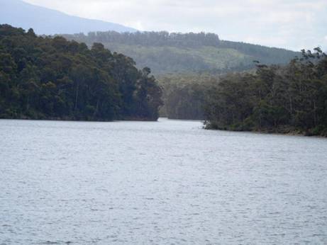
When you come out onto the W18 track (which crosses the dam wall .5 km to your West – great views of the lake) you can also walk up to the gardens and recreation grounds a further 1 km beyond the dam viewing area where there is water and toilets and lot of mown grassy flats, as there is below the dam wall as well.
Moondarra end of the track within site of the railing of the bridge across the spillway.
This lovely stream: Last chance to camp.
The Vic map for this section is Moe North: T8121-1-N
See also: http://www.finnsheep.com/THE%20UPPER%20YARRA%20WALKING%20TRACK.htm
http://www.theultralighthiker.com/upper-yarra-track-update-section-one-moe-yallourn-rail-trail/
Upper Yarra Track: Section Four: Moondarra to Erica:
20 km - 5.5 hours
When you come to the end of the walking track, our walk continues on East along the W18 through beautiful serene forest. The first suitable campsite, a really beautiful spot with water is when the trail crosses Jacob’s Creek on the Old Traralgon ‘Road’.
It is about 11 km and 3 hours easy walking away. Follow the W 18 East 1.5 kms. You will see an old (closed) bush track exiting North. This loops back onto the W18 about 1km further along. It can be taken to provide scenic views of the dam, and a quieter walk (though the W18 track is never busy). It adds about 1.5 km to the trip. You could possibly camp along it and scramble down to the lake for water, but it is a fair way.
Gardens at
Otherwise you walk along the W18 for approx
3.5 km to just before the tar road (1-200 metres). You will see a motorcycle
track join the W18 from the South and exit it to the North where it has more
the appearance of a dirt road. This motorcycle track parallels the main road
(about 100 metres inside the bush) all the way to the
If you are short of water you can take one of these and go out on to the main road (also not busy) as there are fire dams along it (at least ten of them!) every .5 km or so; the last being just after your turn-off at ‘Conference Corner’, where you would turn to go to Cowwarr Weir and Brunton’s Bridge if you were heading that way. Each of these dams is set back 20-30 metres from the main road and surrounded by a grassy flat. I imagine you could find somewhere along here to camp if you needed to.
It is approximately 5 km to the W2 Track or
‘
Jacob’s Creek to Erica: 9 km (2.5 hours) No water until you get to Erica.
Jacob's Creek.
Leaving this camp continue West on the Old
Traralgon Road 1.5 km until you come to the Old Coach Rd then turn North.
Follow it 1.5 km until you come to Bluff (or Jacob’s
Jacob’s
As you come in to Erica there is a Hotel
(which serves excellent meals) on the West side of the street and a
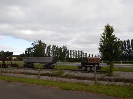
Remnants of the old railway line in Erica.
The Erica Walhalla Rail Trail Begins: Only `12 km to go!
The Vicmaps for this section are Moe North T8121-1-N and Walhalla South T8122-2-S
See also: http://www.finnsheep.com/THE%20UPPER%20YARRA%20WALKING%20TRACK.htm
http://www.theultralighthiker.com/upper-yarra-track-update-section-one-moe-yallourn-rail-trail/
http://www.theultralighthiker.com/upper-yarra-track-update-section-three-wirilda-to-moondarra/
Upper Yarra Track Sidetrip: Horseshoe Tunnel/Coopers
Creek
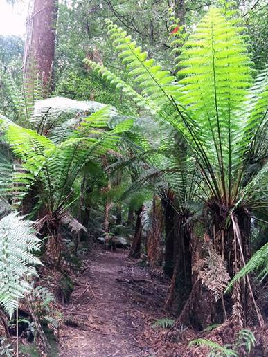
Only a bit over a km from Platina Station on the walk from Erica to Walhalla you can take this lovely walk down to the historic Horseshoe Tunnel. The tunnel was created over a century ago to divert the river so the dry river bed could be sluiced for gold. The sidetrip takes about 1.5 hours (or several days if you decide to camp out!) This early section is fringed with wild cherries. Seats are provided at strategic intervals for the weary traveler.
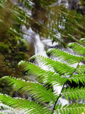
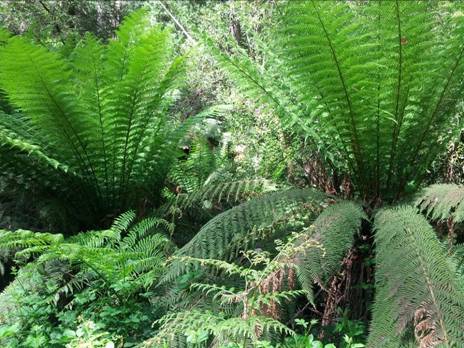
The track passes through a beautiful fern gully as it zig zags down the hill to the river.
There is some good timber along the way.
At the bottom there is this delightful picnic table and informative signs. You could easily camp right here. There is a fireplace as well.
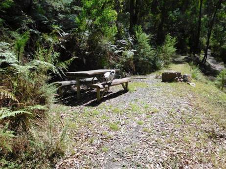
You can see the river exiting from the tunnel if you stand on the table – as I did for this shot.
Close up it looks much fiercer.
You walk alpong the dry river bed to the inlet.
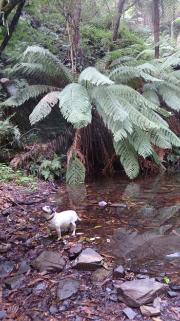
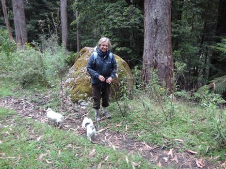
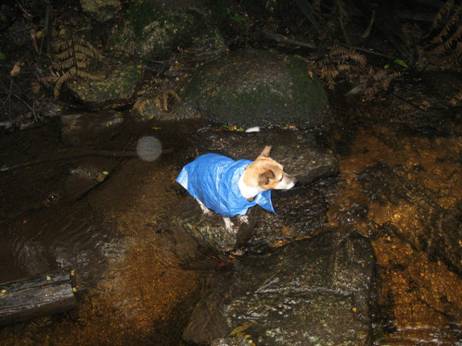
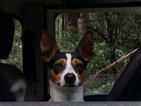
As usual Spot leads the way. Plenty of
places you could camp along here.
The track is fringed with lots of wild mint which casts up a delightful aromatic fragrance – another memento of the pioneer women of yesteryear.
You would not want to accidentally fall into the inlet. You would be pretty sore and sorry by the time you came out the other side – if you lived to tell the tale at all! Apparently on the day it opened the builder, his wife and children were swept through it – and they survived!
There is a beautiful beach both at the inlet and the exit – lovely places for a swim on a hot day.
Spot and Tiny were more interested in lunch than in the tunnel – background.
This shaggy local barely noticed us as we passed.
And extensive camping opportunities (with toilet facilities).
The Vicmap for this section is Walhalla South T8122-2-S
See also:
http://www.finnsheep.com/THE%20UPPER%20YARRA%20WALKING%20TRACK.htm
http://www.finnsheep.com/Track%20Instructions.htm
http://www.theultralighthiker.com/upper-yarra-track-update-section-one-moe-yallourn-rail-trail/
http://www.theultralighthiker.com/upper-yarra-track-update-section-three-wirilda-to-moondarra/
http://www.theultralighthiker.com/upper-yarra-track-section-four-moondarra-to-erica/
Mobile Phone works beautifully until you plunge downhill
towards the
See also Upper Yarra Track Winter Route:
http://www.theultralighthiker.com/western-tyers-river-great-for-crays/
http://www.theultralighthiker.com/the-western-tyers/
http://www.finnsheep.com/THE%20UPPER%20YARRA%20WALKING%20TRACK.htm
http://www.theultralighthiker.com/upper-yarra-track-update-section-one-moe-yallourn-rail-trail/
http://www.theultralighthiker.com/upper-yarra-track-update-section-three-wirilda-to-moondarra/
http://www.theultralighthiker.com/upper-yarra-track-section-four-moondarra-to-erica/
http://www.theultralighthiker.com/upper-yarra-track-section-five-erica-to-walhalla/
http://www.theultralighthiker.com/upper-yarra-track-summary-cumulative-distancestimes/
http://www.theultralighthiker.com/upper-yarra-track-osheas-mill/
http://www.theultralighthiker.com/a-beautiful-world/
http://www.theultralighthiker.com/upper-yarra-track-winter-route-caringal-scout-camp-tyers-junction/
http://www.theultralighthiker.com/upper-yarra-track-winter-route-western-tyers-to-tanjil-bren/
http://www.theultralighthiker.com/kirchubel-if-you-go-nowhere-else-in-the-world-at-least-go-here/
http://www.theultralighthiker.com/upper-yarra-track-winter-route-downey-to-newlands/
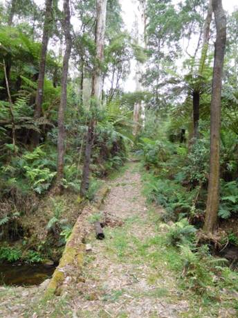
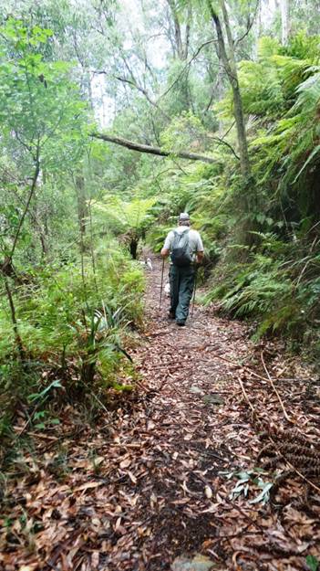
Upper Yarra Track: Section Five: Erica to Walhalla:
12 km – @ 4 hours.
It is 2 km (a bit over half an hour) along
the rail trail to the
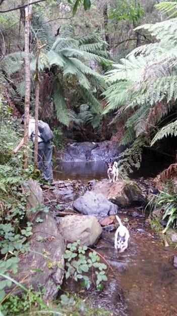
Half way (3 km) along the trail (Platina Station – shelter hut) you can turn off and drop down (2 km) to Coopers creek on the Thomson where there is a popular camp ground (toilets, water). The hotel there is now (unfortunately) closed.
From Platina Station you can also take an (approx ½ hour each way) excursion to the ‘Horseshoe Tunnel’ (http://www.visitbawbaw.com.au/walking-cycling/horseshoe-bend-tunnel) a river diversion put in during the early C20th to extract gold from the stream bed (Toilets, water, camp). The whole river was intended to flow through, it thus granting access to any alluvial gold in the river bed.
From Thomson Station to Walhalla Station
along the rail trail (watch out for trains!) is about 4 km (1 hour). Walking is
not allowed on the railway line. You can walk along the ‘Alpine Walking Track’
what used to be (part of) the Poverty Point Tramline (as we did), or the Mormon
Town Track& Telecom Tracks or along the main road. Both start on the true
left bank immediately you cross the bridge across the Thomson. There is a trail
on either side of the river upstream of the Thomson road bridge. The one on the
West bank can be used to access the
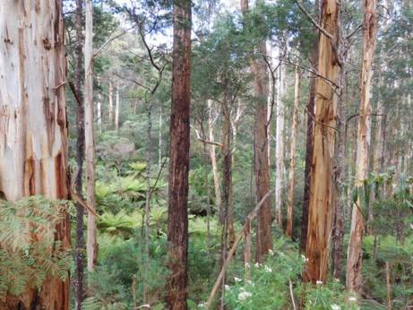
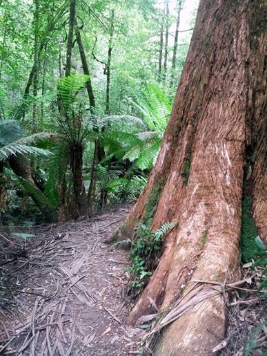
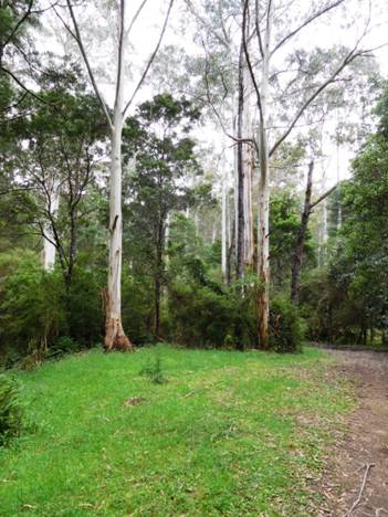
The trail passes though some magnificent
timber (huge mountain ash, vast tree ferns, etc – with magnificent views down
to the mighty
The
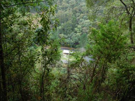
There is plenty to see and explore in and
around Walhalla. You may want to spend a few days thereabouts. If you have never been there before you are going to be astonished
by the beauty (and history) of this quaint old gold mining town nestled in the
deep valley of Stringers Creek. Take a look at
the cemetery and cricket ground. Maybe do a tour of the Long Tunnel mine. Most
of the buildings are authentic mid C19th. Heading out of Walhalla you can
divert via Rawson to pick up additional supplies if needed before you tackle
the beautiful and awesome Baw Baw
Plateau. For example, a side trip via Happy-Go-Lucky to
The
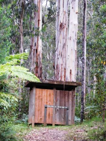
The trail begins just as you enter Erica on the East side of the road opposite the hotel next to a shelter, convenience stop and caravan park and these mementoes of the region's logging history.
Right on the outskirts of Erica the trail plunges from lush green paddocks replete with fat kine into the enfolding forest.
Minutes out of Erica a lovely dam makes for a refreshing rest stop.
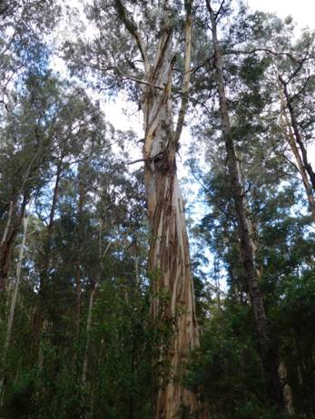
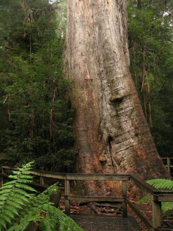
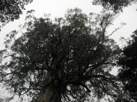
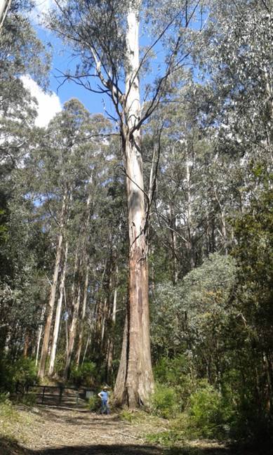
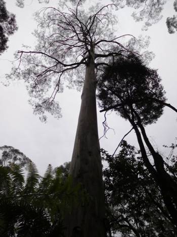
Straightaway you plunge into magnificent mountain ash country: this species is the tallest tree/plant in the world.

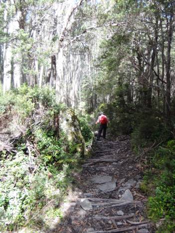
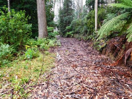
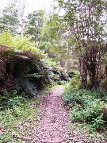
The trail is in wonderful condition.
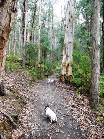
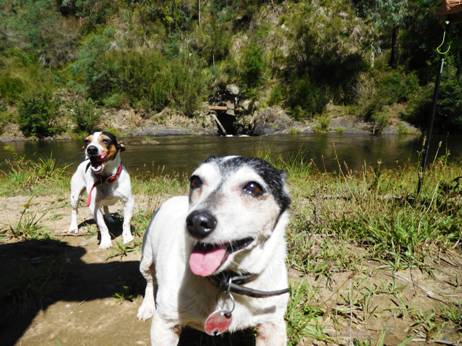
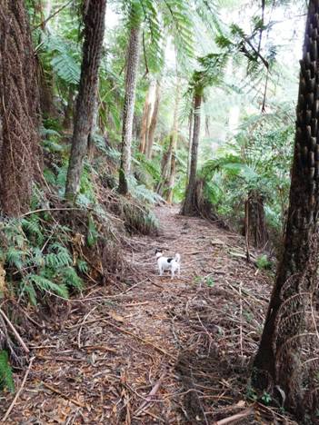
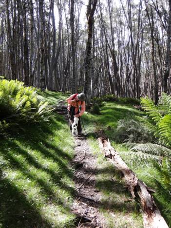
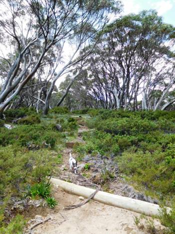
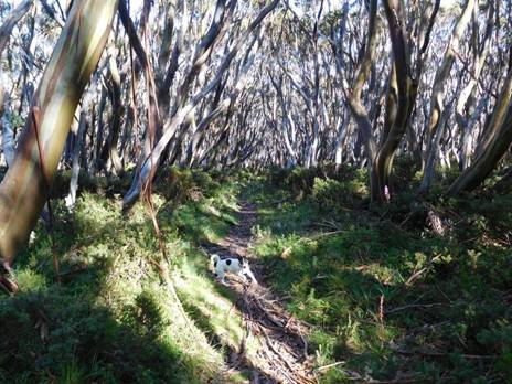
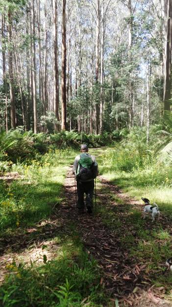
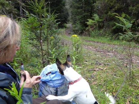
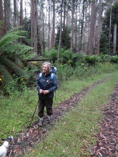
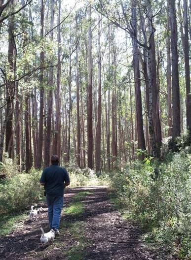
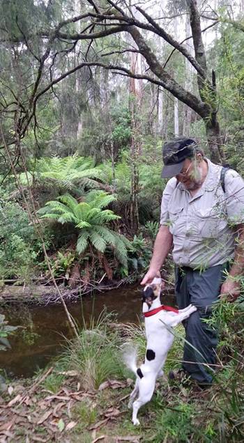
As always the Jack Russels Spot and Tiny lead the way.
Through beautiful tree fern tunnels.
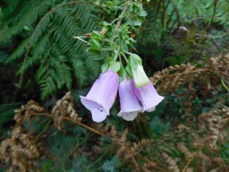
Along the way a very late summer foxglove in a shady nook is a touching reminder of the C19th goldfields women who followed their menfolk to the ends of the earth.
After about 40 minutes the track crosses
the
Once again you are plunged into magnificent ash and tree fern. As we were walking this section we heard a sound like a cannonade as one of these giants crashed unexpectedly to the ground. This happens often over summer. Gums are ‘self-pruning’ – a dangerous habit should you be foolish enough to camp underneath one!
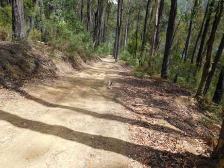
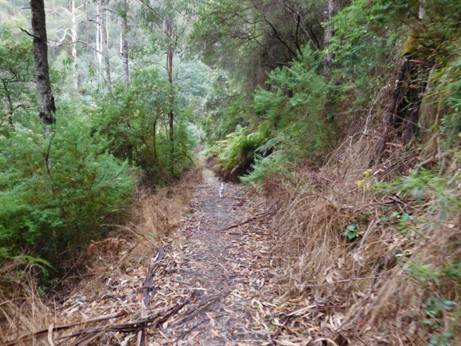
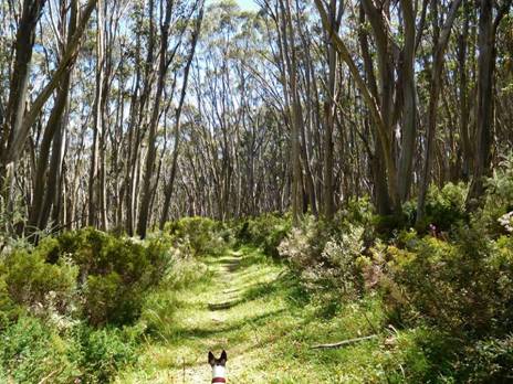
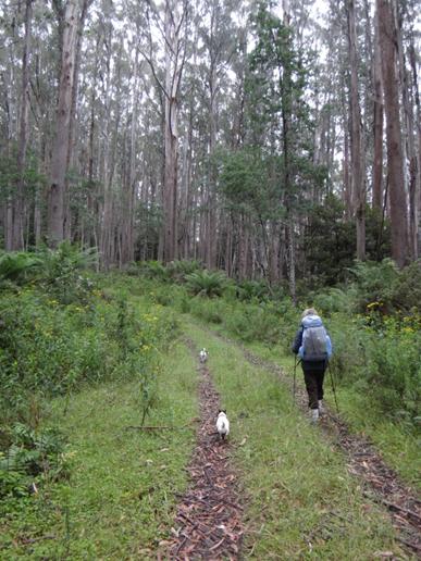
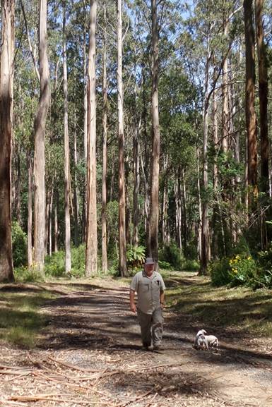
The track is wide enough most of its length that two can walk abreast.
After Micah Creek (water, camp) Platina
Station marks the turn off for
The Horseshoe Tunnel diversion track below: as you can see an easy portage if you are packrafting the Thomson.
There are many glimpses of the mighty
It is a lovely wide well-graded track: easy walking. Spot, as usual is out in front.
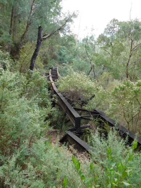
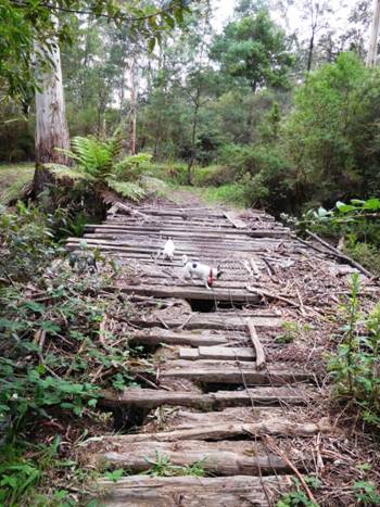
Many mementoes of the old Moe-Walhalla line along the way. A fallen bridge.
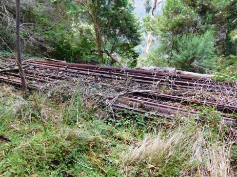
Abandoned railway tracks.
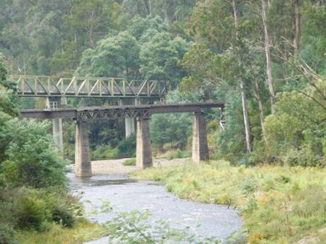
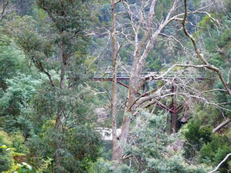
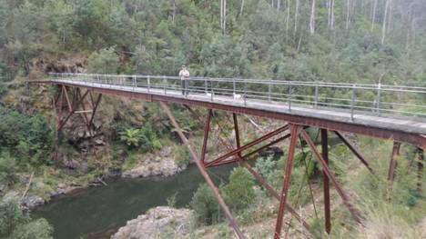
Road and rail bridges span the river at Thomson Station. You can see from their height how far this river can rise.
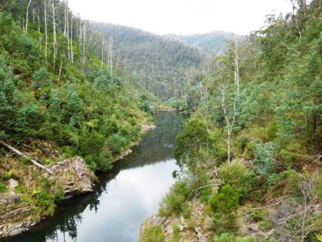
The Thomson is a beautiful river to canoe: view upstream from the Thomson road bridge towards the dam (starting point).
After crossing the Thomson, the
The Australian bush is always a riot of wildlowers. Indeed very few places offer the bewildering array of species you find all about you here.
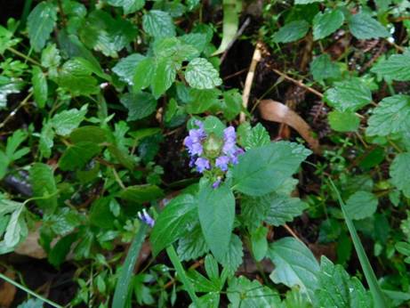
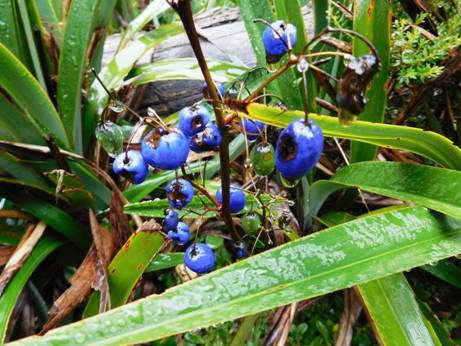
Native Bugle flower.
Native trigger flower: a carnivorous variety.
This is a wild cherry. It is a parasitic plant with an edible fruit (hence the name). It is only one of two trees in the world which bears its nuts outside its fruit (hence ‘exocarpus’), the other being the pecan.
The Poverty Point tramline was in many places hacked out of a near vertical hillside. The main road is about fifty metres below - straight down!
Early glimpses of Walhalla through the trees: below the new 'Visitor's Centre'.
Early settlers could not quite believe Australian Eucalypts, a dominant genera in today's landscape as they kept their leaves whilst shedding their bark. Another annoying habit they have is turning their leaves to avoid the sun, thus casting little shade on a hot day.
There are some majestic examples in the wetter gullies. Hard to believe that a hundred years ago there was not s single tree growing within thirty kilometres of Walhalla - so great was its voracious appetite for wood! They are quite quick growing. Trees which sprang up from seeds after the 1939 fires had trunks which made a single semi-trailer load a mere fifty years later.
Spot really enjoys a walk. He is way ahead of Della here.
The road goes ever on and on...That is bark on the track, though we did see a small snake and a water dragon at the river crossing – and at least fifty species of birds!
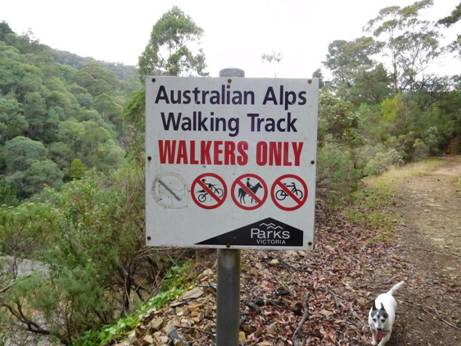
Someone had removed one of the forbidden things on the sign. Tiny cannot believe it was 'dogs'. We saw indications that both horses and pushbikes have also ‘strayed’ onto this lovely track. Someday no doubt such misdeeds will be a capital offence! Or forgotten quite.
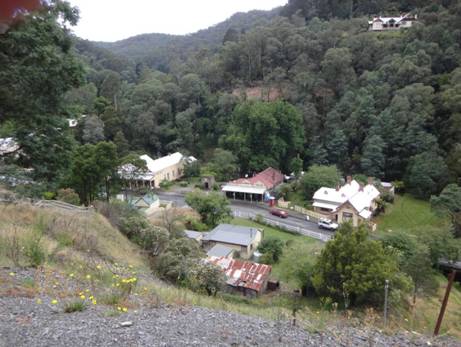
At trail's end Walhalla lies nestled in
the
See also:
The Vicmap for this section is Walhalla South T8122-2-S
See also:
http://www.finnsheep.com/THE%20UPPER%20YARRA%20WALKING%20TRACK.htm
http://www.finnsheep.com/Track%20Instructions.htm
http://www.theultralighthiker.com/upper-yarra-track-update-section-one-moe-yallourn-rail-trail/
http://www.theultralighthiker.com/upper-yarra-track-update-section-three-wirilda-to-moondarra/
http://www.theultralighthiker.com/upper-yarra-track-section-four-moondarra-to-erica/
See also Upper Yarra Track Winter Route:
http://www.theultralighthiker.com/western-tyers-river-great-for-crays/
http://www.theultralighthiker.com/the-western-tyers/
http://www.finnsheep.com/THE%20UPPER%20YARRA%20WALKING%20TRACK.htm
http://www.theultralighthiker.com/upper-yarra-track-update-section-one-moe-yallourn-rail-trail/
http://www.theultralighthiker.com/upper-yarra-track-update-section-three-wirilda-to-moondarra/
http://www.theultralighthiker.com/upper-yarra-track-section-four-moondarra-to-erica/
http://www.theultralighthiker.com/upper-yarra-track-summary-cumulative-distancestimes/
http://www.theultralighthiker.com/upper-yarra-track-osheas-mill/
http://www.theultralighthiker.com/a-beautiful-world/
http://www.theultralighthiker.com/upper-yarra-track-winter-route-caringal-scout-camp-tyers-junction/
http://www.theultralighthiker.com/upper-yarra-track-winter-route-western-tyers-to-tanjil-bren/
http://www.theultralighthiker.com/kirchubel-if-you-go-nowhere-else-in-the-world-at-least-go-here/
http://www.theultralighthiker.com/upper-yarra-track-winter-route-downey-to-newlands/
Mobile Phone works beautifully until you plunge downhill
towards the
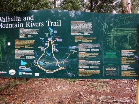
The Upper
Yarra Track: Walhalla to Warburton:
from John Siseman’s ‘Australian
Alps Walking Track’
14/03/2016: Upper Yarra Track Side
Trip: Poverty Point: From the Thomson River
Bridge/s (‘Thomson Station’) you can walk a lovely 8 km circuit up along the
West bank of the river then down along the East bank. If I were walking the
entire UYT I would come down to Thomson Station as soon as it joined the Mormon
Town Track and walk up the West bank as it is far more beautiful, and would
otherwise be missed – as would the two excellent campsites to be found along
it. The first only about 200 metres from the main roads is large enough for
several caravans (there was a 25’ one parked there as we walked by). The second
campsite is on a large flat along the river about 300 metres below the
Within 100 yards of the main road you
start to see these beautiful fern gullies. You cross
Both tracks follow the routes of old timber tramlines so they are delightful easy going. A Jack Russell like Spot can really tear along them!
Here he comes again!
The track on the West side provides
splendid views of the beautiful
There are plenty of cool, shady areas to stop and rest. Soon you come to the second stream:
'By channels of coolness the echoes are calling,
And down the dim gorges I hear the creek falling’ Bellbirds, Henry Kendall: http://www.mountainman.com.au/kendall.html
You can dimly glimpse the waterfall above the last photo.
After about 1.5 hours the
Unbelievably the bridge was constructed
(prefabricated) in
View downstream from the bridge: you can just make out the flat in the river mentioned earlier where you can camp.
Tiny is 16 but still enjoys a long walk (and a cool puddle). This is a stream on the east bank. She is looking up to a bench where once a timber getter's house stood. They had cellars under their bark huts for milk/cheese (from their goats) and pocket handkerchief vegie gardens up along the streams. Saturday nights they would walk (10 km) into Walhalla to socialise. In the past people had to ‘make do’. They raised a nation of strong, independent people.
Maps
for this section:
Walhalla South T8122-2-S and Avenza Pdf
App.
See also:
http://www.finnsheep.com/THE%20UPPER%20YARRA%20WALKING%20TRACK.htm
http://www.finnsheep.com/Track%20Instructions.htm
http://www.theultralighthiker.com/upper-yarra-track-update-section-one-moe-yallourn-rail-trail/
http://www.theultralighthiker.com/upper-yarra-track-update-section-three-wirilda-to-moondarra/
http://www.theultralighthiker.com/upper-yarra-track-section-four-moondarra-to-erica/
http://www.theultralighthiker.com/upper-yarra-track-section-five-erica-to-walhalla/
http://www.theultralighthiker.com/upper-yarra-track-section-nine-phillack-saddle-to-block-10-road/
http://www.theultralighthiker.com/upper-yarra-track-ada-tree-to-big-pats-creek/
See also Upper Yarra Track Winter Route &
Side Trips:
http://www.theultralighthiker.com/western-tyers-river-great-for-crays/
http://www.theultralighthiker.com/the-western-tyers/
http://www.finnsheep.com/THE%20UPPER%20YARRA%20WALKING%20TRACK.htm
http://www.theultralighthiker.com/upper-yarra-track-st-gwinear-track-junction-to-whitelaws-hut/
http://www.theultralighthiker.com/upper-yarra-track-summary-cumulative-distancestimes/
http://www.theultralighthiker.com/upper-yarra-track-osheas-mill/
http://www.theultralighthiker.com/a-beautiful-world/
http://www.theultralighthiker.com/upper-yarra-track-winter-route-caringal-scout-camp-tyers-junction/
http://www.theultralighthiker.com/upper-yarra-track-winter-route-western-tyers-to-tanjil-bren/
http://www.theultralighthiker.com/kirchubel-if-you-go-nowhere-else-in-the-world-at-least-go-here/
http://www.theultralighthiker.com/upper-yarra-track-winter-route-downey-to-newlands/
http://www.theultralighthiker.com/upper-yarra-track-glamping-baw-baw-overnight-hike/
http://www.theultralighthiker.com/upper-yarra-track-side-trip-poverty-point/
http://www.theultralighthiker.com/upper-yarra-track-sidetrip-horseshoe-tunnelcoopers-creek/
30/11/2015:
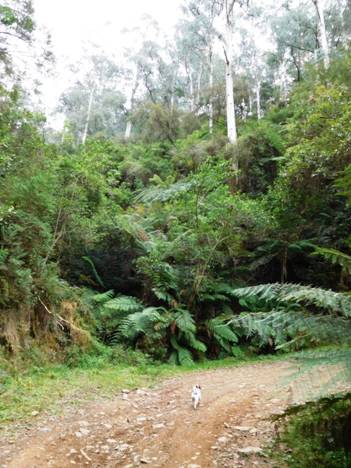
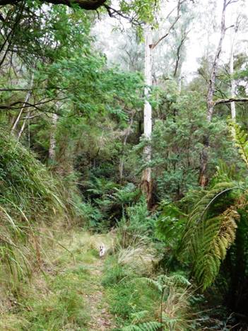
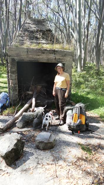
O'Shea's Mill
Even a picnic table in a sunny clearing.
Lots of grassy flat spots to pitch a tent.
Mountain Ash grow quickly. This one easily 2-2.5 metres diameter at the base is likely younger than me!
Pristine water from the
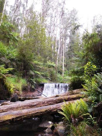
Or a waterfall.
Australian Alps Walking Track near
09/01/2014: Ah, the rush to publish…Della has beaten me hands down
on this one – I blame a nasty episode of Meniere’s: Foxbaits laid on our
intended route, we ventured instead into the Baw Baw Nat Park (of course not
telling the dogs; they were doing anything wrong – you wouldn’t want to fill
them with guilt; they were enjoying themselves too much). I used to hunt over
that whole area with hounds before it was declared a
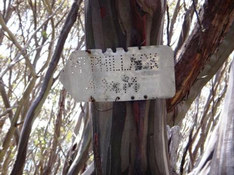
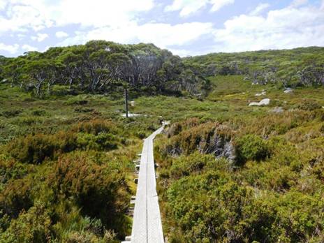
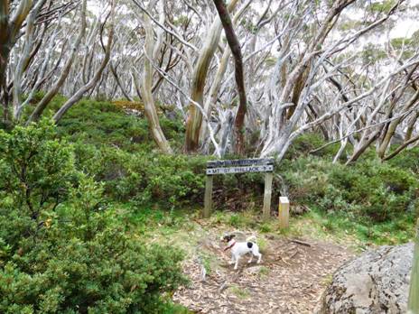
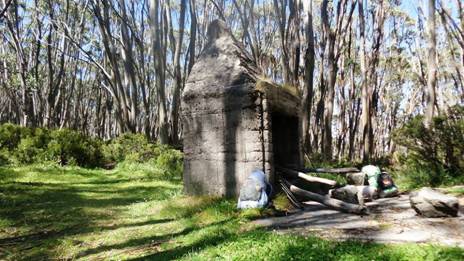
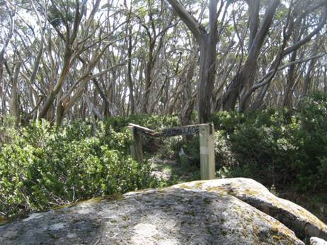
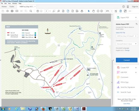
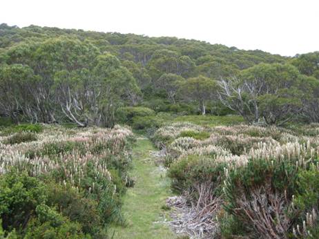
23/02/2016: Upper Yarra Track Section Seven: Mushroom Rocks Carpark to Phillack Saddle:
This is a beautiful easy section comprising widely varying vegetation and topography, the spectacular ‘Mushroom Rocks’, the ruin of the Talbot Peak hut, Mt St Phillack, the highest point on the Baw Baws, and a delightful camp at Phillack Saddle. Side trips can be taken to Mt St Gwinear and Baw Baw Alpine Village.
It is about 20 minutes walk from the car park (toilets,
water, scenic side-trip) to the Mushroom Rocks where there is scout hut
accommodation if you have arranged it. It is another hour to
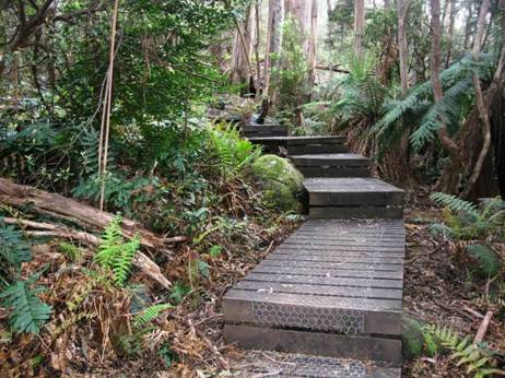
Some parts of the track are even board-walked. You won’t get your shoes dirty as far as Mushroom Rocks at least.
Lots of lovely smells to interest the dogs who wondered which generation (of dogs) was this all being 'saved' for. Well, this one apparently!
Mushroom rocks shelter, There is another (one person) at the St Gwinear turn-off.
You can see why they are named 'mushroom rocks'.
These alpine meadows are delightful.
There is a small steepish section.
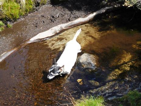
Water often collects in hollows in rocks or weeps out from underneath them. Tiny slakes her thirst.
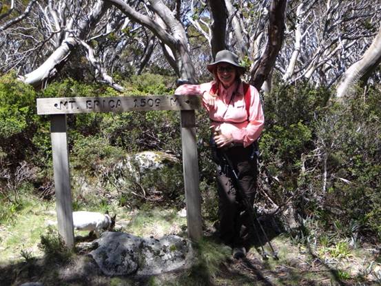
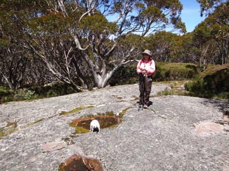
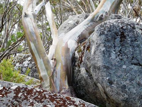
Mt Erica summit.
Suddenly you break out into an entirely different landscape.
The dogs were as puzzled as we were by
where the stream at
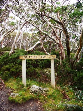
Remains of the old
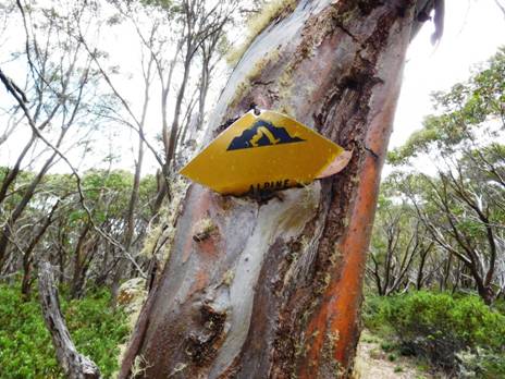
An old sign at
The plateau is easy walking. Surprisingly flat, in fact.
The path is wide and well maintained. Many places two can walk abreast.
Here and there are small clearings inviting solitary camps if you have thought to carry enough water from the last supply.
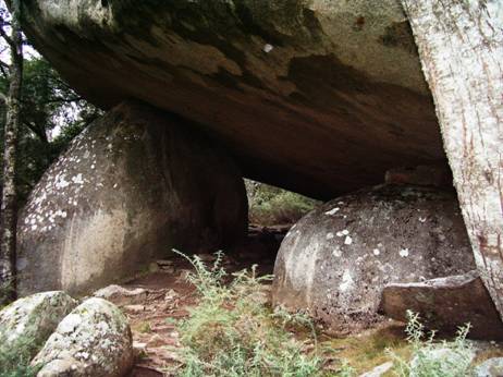
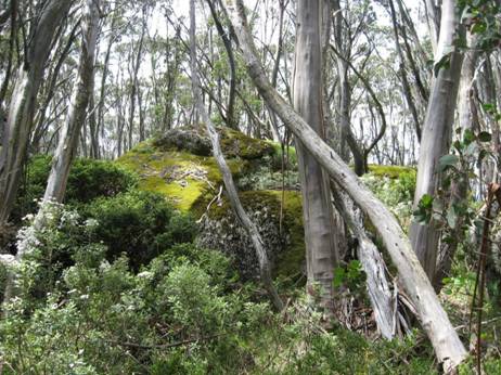
Huge granite boulders are common all over the plateau. It would not have been so pleasant on the day they were falling from the sky!
In many places the terrain and vegetation are clearly windswept. It us a good walk to carry a few extra tent pegs.
There are many lovely scenes to greet the eye.
As you cross the plateau you get only occasional glimpses of what would be a magnificent view if only they would cut all the wretched trees down!
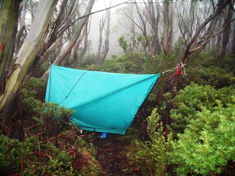
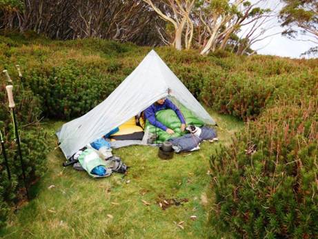
One wet night I camped right across the track in my hammock. It rained during the night turning the track into a stream 150mm deep. Yet I stayed dry – one of the advantages of hammock camping. During the night it was so humid that a light rain fell under my hammock tarp. The DWR on my sleeping bag handled it fine.
Mt St Gwinear track intersection looking towards Mt St Gwinear.
View towards Mt St Gwinear from the track intersection. Water can be obtained from the North Cascade Creek below.
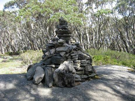
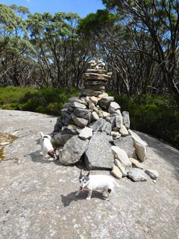
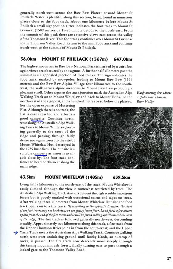
Mt St Phillack (cairn) the highest point on the plateau.

Phillack Saddle just before the turn-off to Baw Baw is a fine place for an overnight camp. Water on the South side.

This is the real turn-off to Baw Baw a hundred metres or so past Phillack Saddle heading West. The old track exited right at the saddle but is unmaintained and well-nigh impassable today (though scenic). Whereas it takes about 1.5 hours to walk across the new route it takes twice as long on the old.
PS: My thanks to Gerard White for some of the preceding photos.
Telstra NextG mobile phone works most places across the Plateau.
Maps for this section:
Mostly Walhalla North T8122-2-N and part of WalhallaSouth T8122-2-S and Avenza Pdf App.
See also:
http://www.finnsheep.com/THE%20UPPER%20YARRA%20WALKING%20TRACK.htm
http://www.finnsheep.com/Track%20Instructions.htm
http://www.theultralighthiker.com/upper-yarra-track-update-section-one-moe-yallourn-rail-trail/
http://www.theultralighthiker.com/upper-yarra-track-update-section-three-wirilda-to-moondarra/
http://www.theultralighthiker.com/upper-yarra-track-section-four-moondarra-to-erica/
See
also Upper Yarra Track Winter Route:
http://www.theultralighthiker.com/western-tyers-river-great-for-crays/
http://www.theultralighthiker.com/the-western-tyers/
http://www.finnsheep.com/THE%20UPPER%20YARRA%20WALKING%20TRACK.htm
http://www.theultralighthiker.com/upper-yarra-track-update-section-one-moe-yallourn-rail-trail/
http://www.theultralighthiker.com/upper-yarra-track-update-section-three-wirilda-to-moondarra/
http://www.theultralighthiker.com/upper-yarra-track-section-four-moondarra-to-erica/
http://www.theultralighthiker.com/upper-yarra-track-section-five-erica-to-walhalla/
http://www.theultralighthiker.com/upper-yarra-track-st-gwinear-track-junction-to-whitelaws-hut/
http://www.theultralighthiker.com/upper-yarra-track-summary-cumulative-distancestimes/
http://www.theultralighthiker.com/upper-yarra-track-osheas-mill/
http://www.theultralighthiker.com/a-beautiful-world/
http://www.theultralighthiker.com/upper-yarra-track-winter-route-caringal-scout-camp-tyers-junction/
http://www.theultralighthiker.com/upper-yarra-track-winter-route-western-tyers-to-tanjil-bren/
http://www.theultralighthiker.com/kirchubel-if-you-go-nowhere-else-in-the-world-at-least-go-here/
http://www.theultralighthiker.com/upper-yarra-track-winter-route-downey-to-newlands/
24/02/2016: Upper
Yarra Track Sidetrip: Baw Baw to Mt St Phillack:
What a way to escape the heat! Others may flock
to the beach. We give our hearts to the mountains. Mt Baw Baw was to be 8C
cooler than home (with no power) and with a delightful cooling 30 kph breeze.
When we left our car at the bottom of
Take Mueller’s track. Just cross this magic bridge – watch out for trolls!
Once more into the bush dear friends!
Jackie Winters are as common as sparrows up there.
So are native snowdrops! Follow Mueller’s Track. Take every turn to the left until you come to here:

The turnoff to the new (St Gwinear) track near Baragwanath Flat (where the old track also exits – don’t take that!) is impossible to miss. On the way back take every turn to the right. Mt Baw Baw is a maze of tracks. You can wander round in circles for hours! It is very lovely though! The track follows a ridge but crosses two gullies – so water every km.
This one is West Tanjil Creek.
Time for Tiny to have a bath.
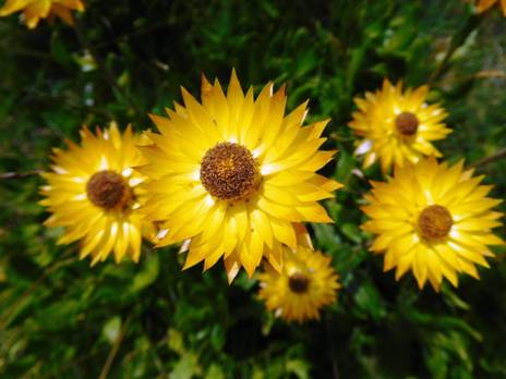
A host of golden everlasting daisies - so much better than those fleeting daffodils!
Spot races ahead, then races back. I was calling him back for fear of snakes. We saw none, but there were innumerable very fat skinks. They must store it against the winter cold.
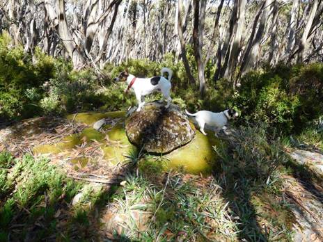
He leaps on a giant tor having similar (lichen) spots to himself.
The intersection with the Alps &

Here we are again at Phillack Saddle (http://www.theultralighthiker.com/upper-yarra-track-section-nine-phillack-saddle-to-block-10-road/ ) Such a delightful place to camp. You can read the track distances if you zoom in (double click). Are we staying again, the dogs want to know. Not this trip.
‘To see a World in a Grain of SandAnd a Heaven in a Wild Flower’ (Blake)
Wonder too at these amazing miniature native violets! The tip of my hiking pole for comparison.
This snow gum has loved this stone ever so long...
And this one galled by man's cruel sign - anthropomorphism is fun, but do not seek truth that way!
At last (after 1.5 hours) Mt St Phillack: Spotty barked several
times at the cairn. His opinion is
This is a walk you might do on a summer trip to Mt Baw Baw. There is plenty of accommodation – even a restaurant: https://mountbawbaw.com.au/
07/02/2016: Della:
Steve and I, with Tiny and Spot, spent the last 2 days walking over the Baw Baw
Plateau from Baw Baw across to
Mueller's cairn, Baw Baw summit. Leaping dogs!
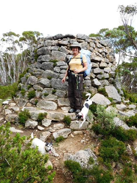
Baw Baw, Mueller's Lookout. Love the bearded fence!
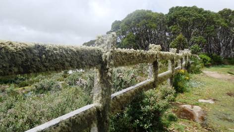
Old (wrong) Baw Baw to Phillack Saddle track. The track is well below the chest height of the vegetation.
But even wrong tracks have their bonuses. This is indeed
a splendid vista. Freeman's Flat.
Phillack Saddle: first night's camp. Dogs being helpful. Tiny went to bed before the tent was up!
Tiny and me warm in in our tent.
Love this pic that Steve took! He was going to snap this fairly mundane rock when the 2 dogs leapt on top and made the picture a winner!
Great scenery. Spot leaping ahead.
Spot leading the way.
Mobile Phone works most places along the top of the Baw Baw Plateau.
Vicmaps: Walhalla
WARNING: The Vicmaps incorrectly locate the trail from Baw Baw to St
Gwinear as coming off the 'Village Trail' at Baragwanath Flat: This is the old
trail which is well-nigh impassable (though we did!). The new (well-maintained)
trail begins a little west of there and exits onto the Alps Walking Track West
of St Phillack Saddle (where there is an excellent campsite with water), not
right at the saddle as does the old trail. Warning 2: Trails down from the Alps
Walking Trail to
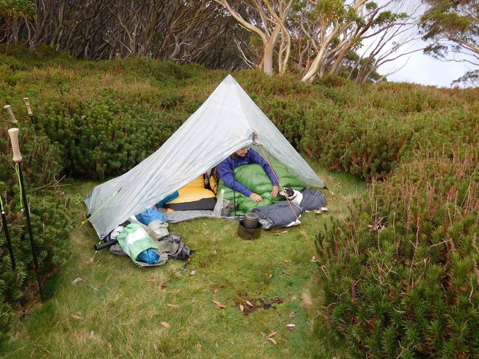
23/02/2016: Upper Yarra Track Section Eight: Phillack Saddle to Block 10 Road:
What a lovely section of track! The high country has so much beauty, so many surprises. Phillack Saddle is a wonderful spot to camp on lawns tended by nature’s gardeners amid the alpine heath. There is beautiful clear water just off the saddle and a lovely stream (below) at Freeemans Flat. It will be about 7.5 hours to our car at the Block 10 Road – if we make it!
Phillack Saddle
Freemans Flat
100 yards after Phillack Saddle you come to the new track across to Baw Baw
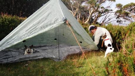
Spot helped put up the Zpacks Solo Plus tent whilst Tiny rested.
Della and Tiny went to bed early. They are old girls!
The new Maratac torch makes a great lantern: http://www.theultralighthiker.com/mini-super-torch-a-weeks-light-weighs-50-grams/
Tiny was tired out. She is 16 1/2.
There are other lovely spots to camp along the way but no water
until Whitelaws Hut and then .5 km after
the
The dogs demonstrate: '
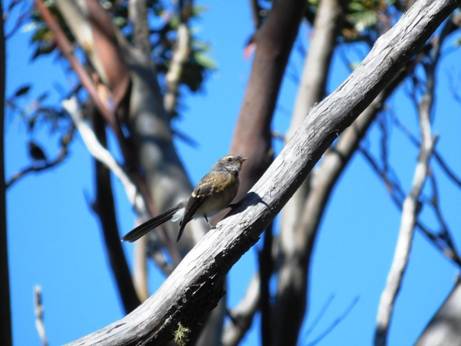
There are many friendly critters along the way: fantail.

'Hurry Up' says Spot.
We are always too slow for him. He is only 3!
Here we are for lunch at Whitelaws Hut. There are plenty of camps here.
Tiny helped hreself to a muesli bar from my pack when I wasn't looking. Chewy!
Many beautiful flowers adorn the path.
And interesting denizens: this was the fattest skink I have ever seen. Must have been nearly 1" in diameter but only 6" long!
An hour after Whitelaws Hut you hit an old road - which shou;ld be kept clear for emergencies and park maintenance in my opinion, but it is neglected.
You can easily walk abreast along here.
This is the turnoff. Turn downhill, South. Parks have stuffed a hopeless map between the timbers. That is the sum total of their efforts.
There were many beautiful sites in this section, but as much of it needed slashing, Inforgot to take photos.
Lots of spots you could camp on the way down to Newlands. There is water as well where you first cross the Thomson - which is 60 cm wide at this point. The road is wide and level.
A huge dead tree suddenly crashed down as we passed: There but for fortune...

The Frangipani Saddle - and the skull of a hiker our dogs pulled down and ate!
Snack time at Frangipani Saddle.
Della striding out once more.
You cross (and parallel) the diminutive
Newlands is just outstandingly beautiful...
And no cars...
Just the bush, Spot and Tiny, and us.
Anything for me, Della? Smackos?

This grnite tor had rolled a long way!
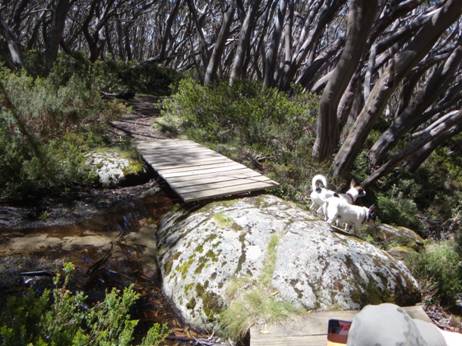
There are bridges so you won't get your feet wet anywhere from the Mushroom Rocks car park.
After the last crossing you can take a prominent road to the North.
Well something had been eating them. Not me unless I'm sure though.
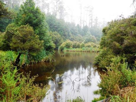
After about half a km there is a pretty little lake full of trout!
A superb camp site. Nobody around.
MMBW Control gates.
We encountered this giant worm pout for a walk!
Figure 1At last, here we are at the Block 10 Road gates. There are a couple of nice spots to camp here, but no water - go back to the lake!
For the section Baw Baw to Phillack Saddle see: http://www.theultralighthiker.com/upper-yarra-track-baw-baw-to-newlands-rd/
This map may help. You should walk along the Village Trail clockwise. That way you will come to the new track to Phillack Saddle before you come to the old which is wee-nigh impassable – though we managed it. On the new track it is 1-1.5 hours; probably nearer 3 on the old. Be warned!
Telstra NextG mobile phone works most places across the Plateau.
Maps for this section:
Mostly Walhalla North T8122-2-N and part of Noojee North T8122-3-N and Avenza Pdf App.
See also:
http://www.finnsheep.com/THE%20UPPER%20YARRA%20WALKING%20TRACK.htm
http://www.finnsheep.com/Track%20Instructions.htm
http://www.theultralighthiker.com/upper-yarra-track-update-section-one-moe-yallourn-rail-trail/
http://www.theultralighthiker.com/upper-yarra-track-update-section-three-wirilda-to-moondarra/
http://www.theultralighthiker.com/upper-yarra-track-section-four-moondarra-to-erica/
http://www.theultralighthiker.com/upper-yarra-track-ada-tree-to-big-pats-creek/
See also Upper Yarra
Track Winter Route:
http://www.theultralighthiker.com/western-tyers-river-great-for-crays/
http://www.theultralighthiker.com/the-western-tyers/
http://www.finnsheep.com/THE%20UPPER%20YARRA%20WALKING%20TRACK.htm
http://www.theultralighthiker.com/upper-yarra-track-update-section-one-moe-yallourn-rail-trail/
http://www.theultralighthiker.com/upper-yarra-track-update-section-three-wirilda-to-moondarra/
http://www.theultralighthiker.com/upper-yarra-track-section-four-moondarra-to-erica/
http://www.theultralighthiker.com/upper-yarra-track-section-five-erica-to-walhalla/
http://www.theultralighthiker.com/upper-yarra-track-st-gwinear-track-junction-to-whitelaws-hut/
http://www.theultralighthiker.com/upper-yarra-track-summary-cumulative-distancestimes/
http://www.theultralighthiker.com/upper-yarra-track-osheas-mill/
http://www.theultralighthiker.com/a-beautiful-world/
http://www.theultralighthiker.com/upper-yarra-track-winter-route-caringal-scout-camp-tyers-junction/
http://www.theultralighthiker.com/upper-yarra-track-winter-route-western-tyers-to-tanjil-bren/
http://www.theultralighthiker.com/kirchubel-if-you-go-nowhere-else-in-the-world-at-least-go-here/
http://www.theultralighthiker.com/upper-yarra-track-winter-route-downey-to-newlands/
Upper
Yarra Track: St Gwinear Track Junction to Whitelaw’s Hut:
The route along the tops is a delightful mix of alpine heath and snow gums. Every couple of kms you will find a small stream (sometimes to the side of the track) with fresh water. For example there is water near the St Gwinear turnoff, just after Mt St Phillack, at Mustering Flat and in the valley next to the Mt Whitelaw Hut site. Gerard White and his partner Bridgette kindly shared these photos from January 2015. Near Mt St Phillack:
Most times of the year (save winter) there is a riot of wildflowers
These lovely little fellows close up.
The path is well defined and maintained.
With many things of interest on all sides.
The grass is well clipped by small herbivores whom you may see morning/evening.
Large granite tors are a feature of the Baw Baws.
There are some lovely vistas.
As the evening shadows lengthen.
Some of these prostrate plants amongst the snow gums are dwarf native pines.
Whitelaws Hut site. There used to be four huts: the first at the
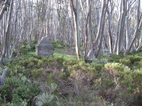
A shame these huts were destroyed by the 1939 fires and never rebuilt. They were quite large, had concrete floors and fireplace, bunks, pots, pans, crockery. Delightful spots to stay as you journeyed along. Still camping out today is not without its pleasures.
Many pleasant views around the hut.
As you lie abed, this is the view of the sky you see.
Water can be obtained from this stream nearby.
Snow gums are very slow growing. Some of these trees are very old.
The path continues on towards its turn-off to
See also:
http://www.finnsheep.com/THE%20UPPER%20YARRA%20WALKING%20TRACK.htm
http://www.finnsheep.com/Track%20Instructions.htm
http://www.theultralighthiker.com/upper-yarra-track-update-section-one-moe-yallourn-rail-trail/
http://www.theultralighthiker.com/upper-yarra-track-update-section-three-wirilda-to-moondarra/
http://www.theultralighthiker.com/upper-yarra-track-section-four-moondarra-to-erica/
See also Upper Yarra Track Winter Route:
http://www.theultralighthiker.com/western-tyers-river-great-for-crays/
http://www.theultralighthiker.com/the-western-tyers/
http://www.finnsheep.com/THE%20UPPER%20YARRA%20WALKING%20TRACK.htm
http://www.theultralighthiker.com/upper-yarra-track-update-section-one-moe-yallourn-rail-trail/
http://www.theultralighthiker.com/upper-yarra-track-update-section-three-wirilda-to-moondarra/
http://www.theultralighthiker.com/upper-yarra-track-section-four-moondarra-to-erica/
http://www.theultralighthiker.com/upper-yarra-track-section-five-erica-to-walhalla/
http://www.theultralighthiker.com/upper-yarra-track-summary-cumulative-distancestimes/
http://www.theultralighthiker.com/upper-yarra-track-ada-tree-to-big-pats-creek/
http://www.theultralighthiker.com/upper-yarra-track-osheas-mill/
http://www.theultralighthiker.com/a-beautiful-world/
http://www.theultralighthiker.com/upper-yarra-track-winter-route-caringal-scout-camp-tyers-junction/
http://www.theultralighthiker.com/upper-yarra-track-winter-route-western-tyers-to-tanjil-bren/
http://www.theultralighthiker.com/kirchubel-if-you-go-nowhere-else-in-the-world-at-least-go-here/
http://www.theultralighthiker.com/upper-yarra-track-winter-route-downey-to-newlands/
The Whitelaw Hut Camp site is a couple of km before you get to Mt
Whitelaw. I haven’t yet checked on how clear the track from Mt Whitelaw down to
20/01/2014: Upper Yarra Track Update: After
camping the night in the Block 10 Rd (Toorongo), we headed off along Newlands
Rd towards Mt Whitelaw Hut (ruins) to investigate the section of the Upper
Yarra Track which we wanted to ascertain was ‘clear’. This road is pretty much
the most beautiful road in Victoria: an easy and pleasant walk (turn back when
you feel like it, or camp out in a sunny spot somewhere on the many crossings
of the diminutive Thomson River, or at the trout-filled dam just off it to the
North about two km in). We lunched at the spot where the Upper Yarra Walking
Track diverges from the

Tiny was cold and tired

Start
Many large granite tors are a feature of the Baw Baws. This is a small one.
Lunch: Frangipani Saddle
Frangipani Saddle. Sign reads AWT 3km thataway! Skull of lost walker...
Mt Whitelaw to Warburton: (in reverse order (sorry): I will rewrite these instructions BOTH ways in time, but as they stand they WILL get you through the whole track safely. Read them from the bottom up:
From: Experience Yarra Valley Activities Website: http://www.experienceyarravalley.com.au/?eyv_activity=walk-into-history-big-pats-creek-to-powelltown
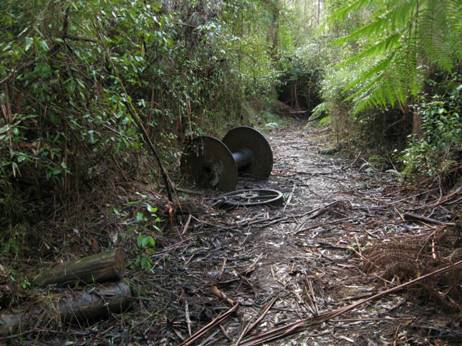
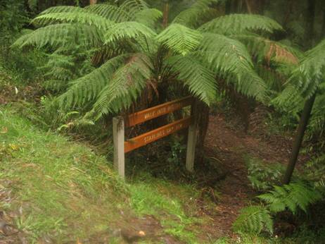
Big Pats Creek / Starlings Gap /
The Walk into History follows some well preserved sections of the historic timber tramlines, past old mills and other relics of the early timber industry. Several creek crossings are required and a map of the area is essential. Due to the steepness of the High Lead section, the easiest way to do the walk is from Big Pats Creek down to Powelltown. The walk can be done in sections as detailed below.
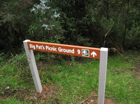
A) Big Pats Picnic Area to Starlings Gap – 9Km, 3.5hrs
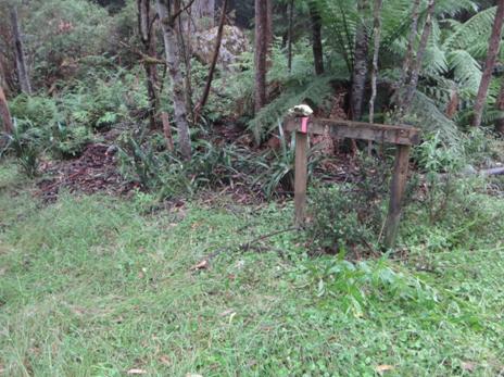
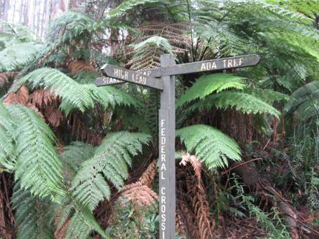
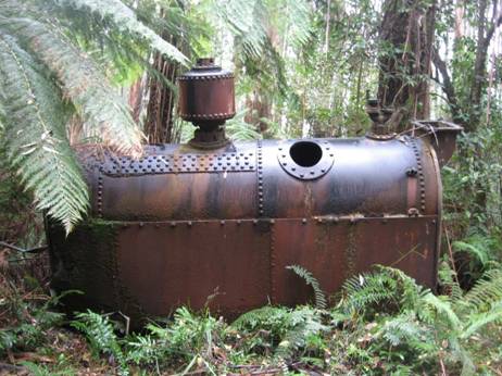
Bush workers used to walk this section of the track on a Sunday evening to be ready to begin work early Monday morning. On a Saturday afternoon however, some workers were known to have run the 9km distance back to Big Pats Creek in time to make the weekly football match. Two sawdust heaps are all that remains to indicate the sites of the bush mills along this section. The first marks the site of Ezards Sawmill, the second near Starlings Gap operated here until 1942. Starlings Gap provides a good place to rest, explore or even camp overnight before beginning the next section. When at Starlings Gap take a few minutes to visit the old winch and boiler located on a level track 200m past the toilet block.
B) Starlings Gap to
The journey to the Ada No. 2 Mill takes walkers through the
Upper
Yarra Track:
As you can see the track is well made, delightful and easy to follow from the Ada Tree all the way to Warburton, with numerous signposts. If you have a couple of days to spare, this is a pleasant jaunt. You can turn it into a loop: http://www.theultralighthiker.com/ada-tree-loop-walk-4-days/ Gerard White and his partner Bridgette completed this section of the walk back in July 2015 (even encountering snow at Starlings Gap!) and have kindly provided the photos below:
The Ada Tree is huge,
With a tiny crown typical of these giant Mountain Ash.
Many photo ops along the trail. Hobbits would like this.
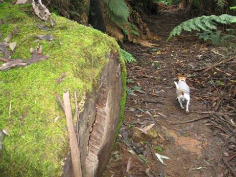
A few stream crossings which do not even daunt Jack Russells –
though they may need a raincoat in the wetter weather. See: http://www.theultralighthiker.com/tyvek-jack-russell-rain-coat-13-grams/
You pass the remnants of a number of old timber settlements, eg ‘The New Ada Mill’,
What a colossal log jam
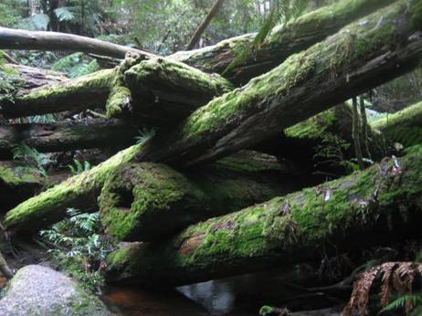
And again. Fortunately you don’t have to scramble over it.
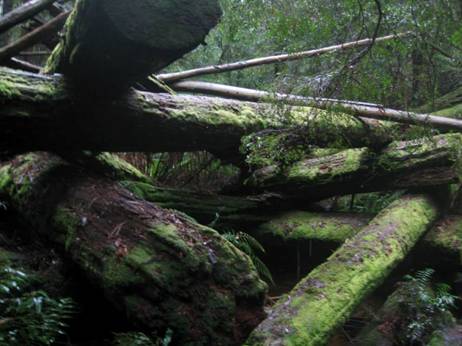
You can gently tiptoe round it.
Wondrous how the memories of yesteryear meld into the forest.
The turnoff to the Walk into History (High Lead) trail.
Jack Russels always lead the way.
Ruins of an enormous drum used for winch logging.
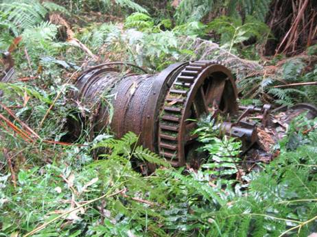
And an old steam boiler
From Starlings gap it is 9 km to Big Pats creek camp ground.
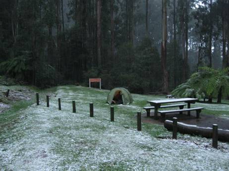
Starlings gap is quite beautiful, and can be reached by car for day walks..
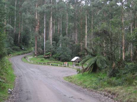
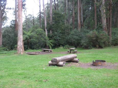
With delightful facilities.
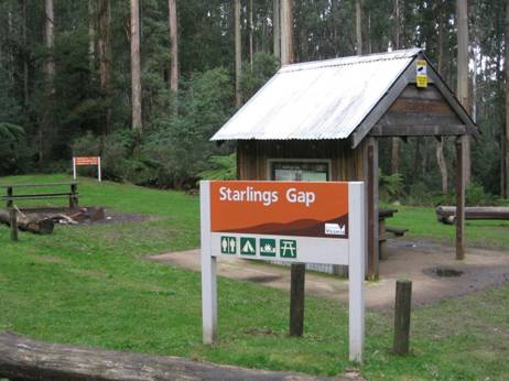
Lots of logs to sit on. Picnic tables, fire pits.
Even a light dusting of snow in July.
A beautiful track leads along the river towards Warburton.
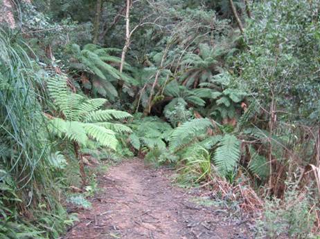
Fringed by some splendid timber.
Delightful mossy logs.
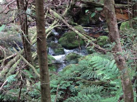
A simply beautiful stream.
Plenty of crays here.
The track is an old timber tramway.
The track begins/ends here.
Big Pats Creek.
Turnoff to/from Big Pats Creek. A pleasant stroll into Warburton: 6-7 km, say 2 hours.
See also:
http://www.finnsheep.com/THE%20UPPER%20YARRA%20WALKING%20TRACK.htm
http://www.finnsheep.com/Track%20Instructions.htm
http://www.theultralighthiker.com/upper-yarra-track-update-section-one-moe-yallourn-rail-trail/
http://www.theultralighthiker.com/upper-yarra-track-update-section-three-wirilda-to-moondarra/
http://www.theultralighthiker.com/upper-yarra-track-section-four-moondarra-to-erica/
See also Upper Yarra Track Winter Route:
http://www.theultralighthiker.com/western-tyers-river-great-for-crays/
http://www.theultralighthiker.com/the-western-tyers/
http://www.finnsheep.com/THE%20UPPER%20YARRA%20WALKING%20TRACK.htm
http://www.theultralighthiker.com/upper-yarra-track-update-section-one-moe-yallourn-rail-trail/
http://www.theultralighthiker.com/upper-yarra-track-update-section-three-wirilda-to-moondarra/
http://www.theultralighthiker.com/upper-yarra-track-section-four-moondarra-to-erica/
http://www.theultralighthiker.com/upper-yarra-track-section-five-erica-to-walhalla/
http://www.theultralighthiker.com/upper-yarra-track-st-gwinear-track-junction-to-whitelaws-hut/
http://www.theultralighthiker.com/upper-yarra-track-summary-cumulative-distancestimes/
http://www.theultralighthiker.com/upper-yarra-track-osheas-mill/
http://www.theultralighthiker.com/a-beautiful-world/
http://www.theultralighthiker.com/upper-yarra-track-winter-route-caringal-scout-camp-tyers-junction/
http://www.theultralighthiker.com/upper-yarra-track-winter-route-western-tyers-to-tanjil-bren/
http://www.theultralighthiker.com/kirchubel-if-you-go-nowhere-else-in-the-world-at-least-go-here/
http://www.theultralighthiker.com/upper-yarra-track-winter-route-downey-to-newlands/
The Ada Tree off
Still some great timber around: 1939 regrowth! — at M15 Track off
Beautiful
03/12/2014: Della: Day 3 of our reconnaissance of the Upper Yarra
walking track: We cannot believe that such an outstandingly beautiful area lies
so close to home and, even more amazingly, so close to
Ada Tree Rainforest Walk near Noojee
Ada Tree Rainforest Walk near Noojee
Ada Tree Rainforest Walk near Noojee
Ada Tree Rainforest Walk near Noojee
Ada Tree Rainforest Walk near Noojee
Ent:
Ent:
Prostanthera looking fabulous at the summit of Mt Horsefall
02/12/2014: Della: Checking out the
View from Mt Horsefall across the
Newlands Track near Toorongo
Myrtle Beech
Tree Ferns
Spot eager to be gone
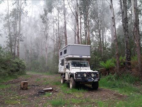
Camp in the Mist Block 10 Rd near Toorongo
Of course there is good water in Walhalla, and from the
1925 Sketch map of
Converted distances taken from 1925 Baw Baw Tourist Maps:
Falls Hut to Falls Creek (4 Chains) = 80 metres
Falls Creek to Main Falls Track (8 Chains) = 160 metres
Thence to View of Upper Falls (81 Chains) = 1629 metres
Thence to Upper Falls Track (7 Chains) = 543 metres
This ‘Sketch map’ is better quality then the one I found before and reveals
details I had not been able to see. For example, I now see that there was a
path down alongside the ‘Minor’ Falls from top to bottom on the true right
bank. Then there was a path from the bottom to just below the main Falls, (from
there a zig-zag path to the bottom of the
I noticed that ‘Big Ben’ has already been there, and that there is a
campsite at the junction of Falls Creek and the
‘I drove along the dirt track to the south of the river and slowed
down to look for the thinnest section of undergrowth to start my walk. There
wasn't one really, so I reversed up and picked
the "thinnest" undergrowth to walk through. After a short distance
the undergrowth became much clearer and the going was much easier. Another 100m
or so and I found a piece of yellow electrical tape hanging from a twig. I
guessed that someone else had marked a track to the first waterfall at the top
of the Falls Creek valley (since there was really nowhere else to go) and sure
enough I found another piece on the same bearing that I was walking. Enough
people had walked this "track" that you could just make out a trail
on the ground. The trail continued along tree trunks wherever possible to avoid
walking through the bush.’
(NB: ‘Ben’ would be referring to beginning in the vicinity of Hill 968 between Toorongo No 3 Rd to the South and Rd 12 to the North off the Forty Mile Break Rd eg on 25K Vicmap Noojee North T8122-3-N)
‘In no time at all I reached the top of the first waterfall. There
used to be a track cut down the north side of the valley that went down to the
other 4 waterfalls just below and then on to
The forest had been reasonably open until this point. It then changed and became hopelessly tangled. The steep slope combined with the almost impenetrable undergrowth and countless slippery branches lying on the ground made the going very hard. I eventually reached the top of the ridge and was disheartened to find that it didn't get any clearer. After struggling through another 100m or so of thick undergrowth it all suddenly disappeared.
The forest opened up
completely with only leaves and logs on the ground. And what logs they were.
It's not often that I have to climb over a log but the trees here had been
saved from logging and the fallen trees were huge. I found no sign of any
blazed trees marking the old trail but occasionally I thought I could see a
levelled overgrown track about 1.5m wide.
I made fairly quick time down the ridge which became steeper and steeper towards the end and as suddenly as the forest had opened up it became a dense tangle once more. The last 100m down the ridge was soul destroying. It required so much effort just to take one step that at one stage I just turned around and pushed through the undergrowth with my back pack. The undergrowth was so thick that I ended up walking on bent, intertwined branches and would occasionally find myself about a metre above the ground.
I eventually made it down
to the beautiful junction of Falls Creek and the
The walk up Falls creek turned out to be a relatively simple one. The entire walk was in amongst a wonderful fern gully. I had to keep swapping from one side to the other as the bank became to steep but there was always somewhere to walk, even if it was on top of a 1.5m wide tree trunk. The only really annoying part was the leeches, but considering the length of the walk I didn't fair that badly.
Eventually I reached it, 'the black hole' as it was sometimes known. The sides of the valley are so steep that from above, you could hear the waterfall but not see it. The falls were a little shorter than I expected and the gorge into which it fell a little wider. This was certainly not, though, a black hole. After emerging from the darkness of the tree ferns this was quite the opposite and I spent most of my time waiting for the sun to go behind a cloud.
The original photograph that I had seen of these falls was taken from a small ledge about 5m higher than the viewpoint for the photographs above. A tree fern obscured the view from this ledge so I didn't bother attempting the tricky climb to it.
I stayed there for lunch before heading back down along the creek. While I made 'good' progress it must have been slower than I thought as I returned to the tent in fading light. After evicting the leeches from my tent I settled down for a good nights sleep in preparation for the walk back through those two stretches of thick undergrowth and a few unexpected finds.
A few light showers overnight had made everything dripping with water but it wasn't really very cold. I decided against putting my waterproof pants on as they would probably make me too hot. This turned out to be a good move. After packing up my campsite I tried to find a break through the undergrowth for my return journey. There were none. It was going to be a couple of hours of take one step, part the branches, put the camera bag on the ground ahead, part more branches, take one small step, part the branches..... over and over.
When I reached the clearer forest again I found a piece of green electrical tape on a small tree. It was on what appeared to be another remnant of the old track, a level section cut across the slope about 1.5m wide. The track went left across the ridge and another piece of tape made me guess that someone had tried to retrace the old track. That's all very nice but I just wanted to go home and I headed straight up the ridge.
The old tourist map of
This part of the creek was typical of the difference between this forest and any other that I had walked through. Normal fire prevention management reduces the amount of dead timber and leaf litter on the ground. Here, in the absence of such practices there were logs everywhere... not just across the creek but everywhere down the slope. This made walking quite tricky with the occasional slide down a slippery log to get the adrenaline going.
While heading back towards the first fall I came across a beautiful
patch of forest. Three giant tree trunks crossed a small creek at different
angles, providing a perfect bridge and an excellent 'aerial' view of the forest
floor. From here I followed the yellow tape back to the road and emerged from
the forest a short distance from my car. What else lies hidden in these
Remember John’s instructions below are from West to East:
Wildlife
& etc:
Snakes: Just about the only people who ever get bitten by a snake
are folk who pick them up to play with them. Don’t. There are a number of
venomous snakes in
13/12/2015: Leeches: In Australia (and elsewhere) it is quite common to encounter these beasties in the wetter areas. They avoid sunny patches. They do you no harm, though many (like me) have an allergic reaction to their ‘bites’, so it is good to avoid them as much as you can. I have already recommended ‘Anthisan’ antihistamine ointment to treat allergic reactions to bites http://www.theultralighthiker.com/insects-can-ruin-a-camping-trip/ (you will have to order it over from a NZ pharmacy) and the practice of using surface spray (eg on your calves), tucking your trousers into your socks and wearing long-sleeve shirts in ‘leechy’ spots such as rainforest areas http://www.theultralighthiker.com/ultralight-personal-hygiene/ .
When you put up your tent for the night you don’t want to erect it on a hundred leeches and have them wriggling all over you all night. I have seen shady areas where when you wave your warm hand over the ground a hundred leeches will stand up and wave at you! You need to carry a small atomiser containing surface spray such as ‘Baygon’ (which can be bought from some supermarkets in bulk - ie not in spray cans) to suit such decanting. Atomisers of various sizes are available all over (try eBay). You will need to match the size to your need. You need to be able to spray the entire footprint of your tent plus an area say a metre around it. If/when you do have a leech attach to you, remember it will do you no harm (indeed they have been used for centuries for their supposed health benefits) and will eventually drop off. If you want to hurry that along a bit, a lighted cigarette or some salt will move them on mighty quickly.
If (like my wife) you don’t like the idea of sleeping on surface spray, carry enough salt in a snap lock bag to sprinkle the same area. This will kill and keep leeches at bay too.

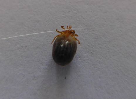
01/09/2015: Tick removal: Spot’s First Tick: This is the very first tick either myself or one of my animals has acquired in Southern Victoria – even though I hunted with hounds here for over thirty years and have owned as many as a dozen and a half dogs at a time. I used to see tiny ticks infecting the ears of Bluetongue lizards probably causing the deafness which results in their suffering from so many road casualties. It is possible to tediously remove them – an operation they lizards do not appreciate – but I have long since given up on it: in no time they find some more anyway.
Spot acquired this particular tick West of Yinnar yesterday when he was trying out his handsome new raincoat (http://www.theultralighthiker.com/tyvek-jack-russell-rain-coat-13-grams/) . I can report I have discovered yet another reason for preferring methylated spirits as a hiking fuel. After dousing the parasite liberally with it (from a teaspoon), and waiting about a minute, it was easy to pull the dead tick out complete with its head (as you can see) leaving nothing to cause an infection or irritation. I used a fine pair of tweezers gripping it just above its head. Easier than pulling a tooth! I have no idea whether it is a paralysis tick (probably not), but you do have to be careful to check your pets for the blighters as they can cause death!
In the US ticks have been implicated in the spread of Lyme Disease (a real nasty previously mostly an occupational hazard to rat-catchers!), so apart from the fact that they will create a very nasty itchy spot, and maybe an infection, it is important to get them out (particularly of yourself) as quickly and safely as possible. The meths is also a good antiseptic.
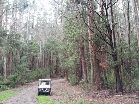
Winter Route: I anticipate people will turn off in winter (or just for a fishing hike anytime) either at O’Shea’s Mill (if they want to travel via Walhalla) or at Collins Siding (just before they get to Erica) and travel to Caringal, Western Tyers, Christmas Creek, Youngs Rd to the Tanjil River, then up the Long Spur and Rowleys to Tanji Bren, Saxtons Rd to Downey and thence back to Newlands Rd. (I am working on these instructions too).
19/05/2015: UPPER YARRA TRACK WINTER UPDATE: Spot
and I planned to finish some further exploration of the path to the
Spot keen to walk the Forty Mile Break behind the locked gate Upper
Yarra Track
01/12/2015: Upper Yarra Track: Winter Route: Caringal Scout Camp: Tyers Junction
You might reach here by walking down the rail trail from Collins
Siding (10 km – 2-3 hours), where the cottages are on the main
See: Tyers Junction Rail Trail: http://www.railtrails.org.au/component/railtrails/?view=trail&id=49&layout=print&tmpl=component
Della, Spot, old railway cutting.
Caringal Webpage: http://www.vicscouts.com.au/caringal.html
There are both powered and unpowered campsites at the Scout camp. I notice other folk camp at the picnic area outside too, or on the roadside across the river. I imagine though a hot shower, proper toilet facilities, undercover cooking, maybe some company etc are worth the $12.
They also have more motel-style accommodation for less intrepid, better-heeled adventurers. Of course there is similar paid lodging elsewhere on the trail, for example: Yallourn North, Erica, Rawson, Walhalla, Mushroom Rocks, Baw Baw, Tanjil Bren, Noojee…
It is a really beautiful spot where the waters of the East and
From Caringal you can journey to
It was really beautiful. A job of clearing for someone, but maybe
not me. It is worth walking along it as far as the old washed out bridge. You
might pick it up on the other side (and if you have your machete with you http://www.theultralighthiker.com/the-worlds-greatest-machete/
) journey on to
See also:
http://www.finnsheep.com/THE%20UPPER%20YARRA%20WALKING%20TRACK.htm
http://www.theultralighthiker.com/upper-yarra-track-update-section-one-moe-yallourn-rail-trail/
http://www.theultralighthiker.com/upper-yarra-track-update-section-three-wirilda-to-moondarra/
http://www.theultralighthiker.com/upper-yarra-track-section-four-moondarra-to-erica/
http://www.theultralighthiker.com/upper-yarra-track-summary-cumulative-distancestimes/
http://www.theultralighthiker.com/upper-yarra-track-osheas-mill/
http://www.theultralighthiker.com/a-beautiful-world/
02/12/2015: Upper
Yarra Track: Winter Route:
From Caringal you can journey to
Pitmans Creek Track.
If you come down the Pitmans Creek Track from Buckle Spur you will first encounter Skinners camp just before you get to the river. It used to be a beautiful well-maintained camping area with toilets, barbecue facilities, shelter, information boards, etc. The Government seems to have abandoned it. You can still camp there though, or you can carefully cross the bridge and camp on the South side of the river. There are lots of blackberries and a few old fruit trees about, so you might get a feed – apart from the abundant trout and freshwater crays in the river. There are rabbits about in the blackberries too, so if you have brought your sling (http://www.theultralighthiker.com/how-to-make-a-sling/ - plenty of stones in the river) , you might be in luck!
Skinners camp.
The dogs managed the bridge - surely you can?
As you cross the river to the South bank there is a river heights
gauge on your left. It was just below .2 metres yesterday and the river quite
canoeable. If you walk East along the riverbank reserve about 200 metres, after
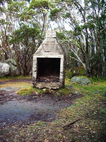
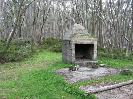
crossing a small rivulet you will come to the abandoned chimney of Morgan’s
Mill which is on private land. There are two or three cottages about. It is
worth a photo. https://en.wikipedia.org/wiki/Western_Tyers,_Victoria
I believe there is a road easement through the two locked gates (you can step
around them) on Morgan’s
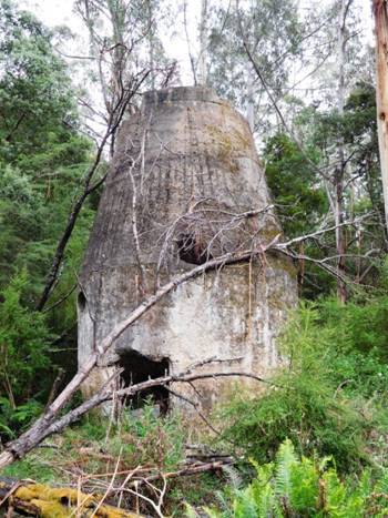
Mill Chimney ruins.
Creates some interesting perspectives...
There are a number of other pleasant spots to camp every km or so as
you make your way to the West along the
Upstream from the bridge.
Downstream from the bridge. Note gauge.
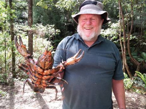
A Note on Crays: These guys are not yabbies. As you can see they are as big as lobsters, and just as delicious! They are easily caught especially if you have some string and bait. Some spoiled meat or fish-heads perhaps. I would usually put out a number of baits along the river in likely spots (near logs, bank overhangs, deep holes, etc) tied to @ 2 metres of string (I find the coloured builder’s line easiest to spot). As you come back to check them you will notice you ‘have’ a cray if the string is taut. Slowly pull it towards you, being sure not to jerk it and frighten HIM off. (Lady crays with babies are always out of season). A trout landing net is handy for scooping him up, or you can pin him with a forked stick, then step into the river and pick him up behind the claws. Don’t let those claws bite: it is as bad as getting on the wrong side of a ferret! If you don’t have any bait or string you can still pin them with a forked stick. A pair of polarised sunglasses will help you spot them on the river bottom where they are greenish rather than the red which is their cooked colour. When you cook them, you only need to wait until they change colour. A couple of minutes at most. If you haven’t a billy large enough, you might need to kill them by plunging a knife through their brains, then breaking them into cookpot-sized pieces - or throw them on the hot coals for a couple of minutes. They are Della's favourite food!
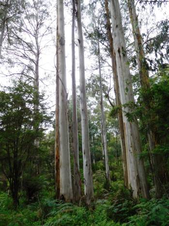
Typical Mountain Ash and Beech forest.
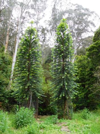
Much less typical, but strikingly beautiful plantation trees: Norfolks?
See also:
http://www.theultralighthiker.com/western-tyers-river-great-for-crays/ http://www.theultralighthiker.com/the-western-tyers/
http://www.finnsheep.com/THE%20UPPER%20YARRA%20WALKING%20TRACK.htm
http://www.theultralighthiker.com/upper-yarra-track-update-section-one-moe-yallourn-rail-trail/
http://www.theultralighthiker.com/upper-yarra-track-update-section-three-wirilda-to-moondarra/
http://www.theultralighthiker.com/upper-yarra-track-section-four-moondarra-to-erica/
http://www.theultralighthiker.com/upper-yarra-track-summary-cumulative-distancestimes/
http://www.theultralighthiker.com/upper-yarra-track-osheas-mill/
http://www.theultralighthiker.com/a-beautiful-world/
http://www.theultralighthiker.com/upper-yarra-track-winter-route-caringal-scout-camp-tyers-junction/
10/12/2015: Upper
Yarra Track Winter Route:
Percy Burn Viaduct,
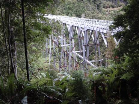
There are a number of pleasant spots to camp along the way. I can’t
tell you how many times my kids played on this old log as they grew. The oldest
is now 34: she first went there when she was two! I have caught a couple of
lovely crays or three underneath it. up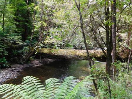
There are two campsites at Palmers. This is the first.
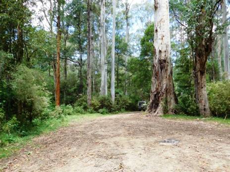
The second one where the bridge used to cross the river is where the tramline carried on to Growlers. It is still possible to walk along it – and the more who do, the easier it will be. You can continue on along the road, but the views of the river and forest are better from the tramway. nowadays.
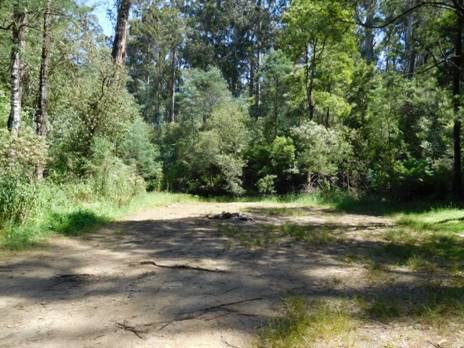
A refreshing dip on a hot day will surprise you how very cold the water is on the South Face of the Baw Baw Plateau.
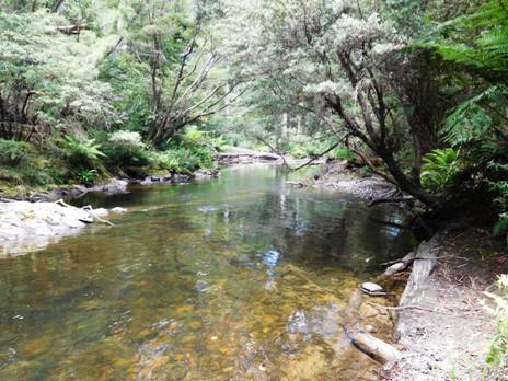
There are some wonderful rapids in this section of the river I used to enjoy when I was suicidally young and ebullient! There is also great fishing. The 2-3 km of the old railway is quite flat – a serene & peaceful camp could be made here and there along it. There is also a single pleasant camp where it rejoins the road just below Growlers, and multiple sites a little over a km further at Growlers itself.
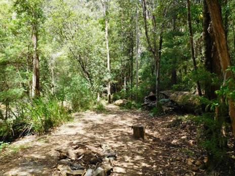
The old railway is easy going in places at least.
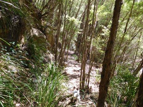
With great views of the river.
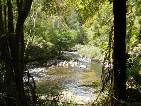
And some amazing rapids.
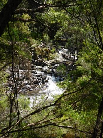
You never tire of watching water flow over stone.
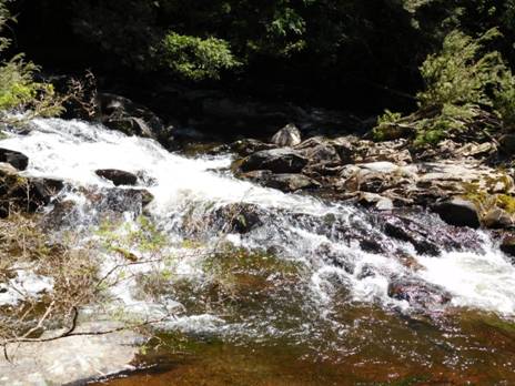
Spot enjoys the view too.
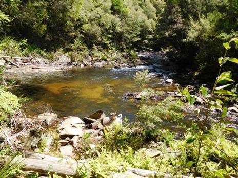
The road carries on up the river to Growlers.
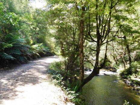
There are many wonderful stands of ash regrowth.
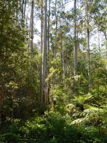
Growlers is a pleasant camp.
A quarter century ago I used to walk across the bridge at Growlers and follow the road which has now disappeared into the forest a couple of kms downstream to where there were immense sawdust piles over 20 metres high scattered along the river flats. Who knows how many forest giants they represented? Their insulative ability and I guess decomposition in their depths made them magically warm spots in the forest where no frost or snow would linger. They were a favourite bedding spot for deer, for that reason. I often put up a fine stag here. The forest is probably far too thick for hunting.
After you come out on to the Tanjil Bren Rd it is only a few kms to the turn off to Christmas Creek, a very pretty camping spot where you may wish to spend a night a couple of kms off your main route.
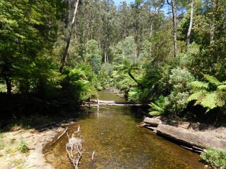
You can imagine camping by the bridge at Christmas Creek for a couple of days.
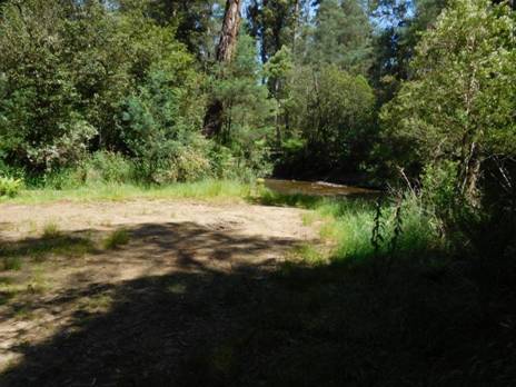
You continue along the
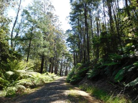
After Tanjil Bren, a really beautiful side trip is to walk west
along the
11/12/2015: Kirchubel:
If you go nowhere else in the world, at least go here. Just a few kms walk
outside the small
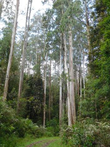
Many beautiful wildflowers carpet the verges: buttercups,
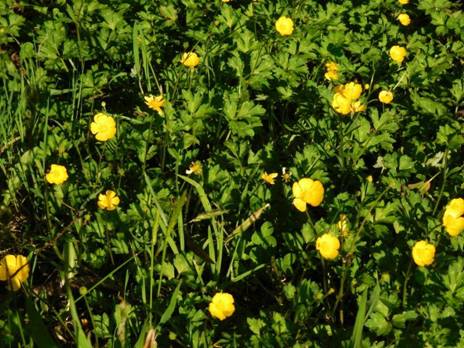
And Alstromoerias.
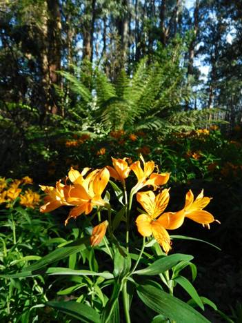
Just before
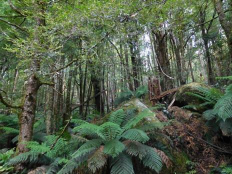
It is so like
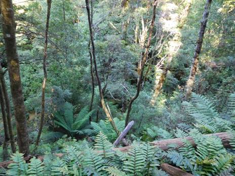
The dogs enjoy the rich, earthy smells of the deep forest litter beneath the majestic gums.
An old (closed) bridge begins Kirchubel‘s Tramway, its exploration to be saved for another day. Maybe some of the 18 old timber bridges yet survive?
The first of the
There is a cast iron pipe at the top of the falls. Water supply to
the lost
Some recollections of this township (lost over 50 year ago) yet
survive: Colin Bigwood writes, ‘In the
early 40's my dad Roley Bigwood, my mum Elsie, and my younger Brother David and
myself Colin went to Kirchubel's sawmill to live. My Dad worked mainly on the
breaking down saw, and had a scar on his right upper-arm to show until he died
where the saw grabbed his thumb while fitting a packing block to the leading
edge of the bottom blade. He also was a leader in on one of the benches. When
we first got there Mr. and Mrs.
21/12/2015: Upper
Yarra Track Winter Route:
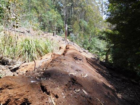
We were looking for a ‘closed road’ which shows on the map Noojee
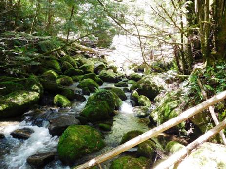
Turns out the GPS and map are seriously ‘out of kilter’ in this small area of map. I have found this before, eg on my walk to Mt Darling last year (http://www.theultralighthiker.com/snowy-bluff-mt-darling-wilderness/) I guess up to a km wrong! This meant I did a fair amount of bush bashing no doubt along what had once been old snig tracks etc, finding nothing but photo ops.
Finally we managed to locate the spot where the ‘road’ had crossed the river. Several huge pipes still lying in the river bed over which we were able to clamber without even getting our feet wet. This was on the way back actually. On the way across we took off our shoes and waded in our Crocs, as it did not appear we could make it dry-footed across the pipes. The water was so chill Della practically had a seizure. Sissy!
After we had crossed the old road was easy to see and we followed it
a couple of kms up the mountain, but not quite as far as
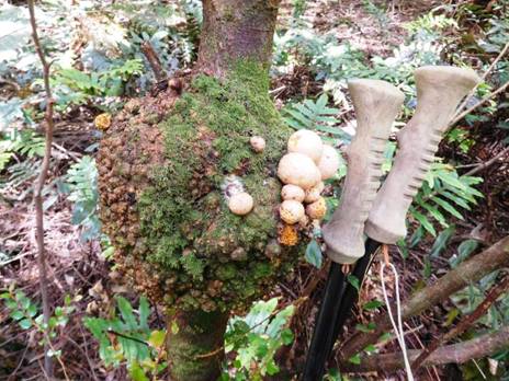
Disease can sometimes look beautiful: observe this amazing gall.
Della has not quite recovered from her (second) eye operation, so we
turned back without having found our way to Frangipani Saddle where this route
meets the ‘Upper Yarra Walking Track’ thus completing our ‘Winter Route’. There
is always room for another adventure. It will most likely be a couple of weeks
before we get back as we are working in the kids’ store Xmas-New Year. We have
cleared and marked the path (with blue tape) from the end of the driveable
section of
http://www.theultralighthiker.com/western-tyers-river-great-for-crays/
http://www.theultralighthiker.com/the-western-tyers/
http://www.finnsheep.com/THE%20UPPER%20YARRA%20WALKING%20TRACK.htm
http://www.theultralighthiker.com/upper-yarra-track-update-section-one-moe-yallourn-rail-trail/
http://www.theultralighthiker.com/upper-yarra-track-update-section-three-wirilda-to-moondarra/
http://www.theultralighthiker.com/upper-yarra-track-section-four-moondarra-to-erica/
http://www.theultralighthiker.com/upper-yarra-track-summary-cumulative-distancestimes/
http://www.theultralighthiker.com/upper-yarra-track-osheas-mill/
http://www.theultralighthiker.com/a-beautiful-world/
http://www.theultralighthiker.com/upper-yarra-track-winter-route-caringal-scout-camp-tyers-junction/
http://www.theultralighthiker.com/upper-yarra-track-winter-route-western-tyers-to-tanjil-bren/
http://www.theultralighthiker.com/kirchubel-if-you-go-nowhere-else-in-the-world-at-least-go-here/
26/12/2015: Up Into
the
Our family celebrate Xmas tomorrow (due to work commitments), so what better day to continue our exploration of the ‘closed track’ which used to link Downey (North of Tanjil Bren) with Newlands Rd (Baw Baw Plateau)? We are hoping that this track will complete our ‘Winter Route’ of The Upper Yarra Track (http://www.finnsheep.com/THE%20UPPER%20YARRA%20WALKING%20TRACK.htm) . It has been very hard going, so we might have to find an alternative track up the ridge from Strahan (North West of Tanjil Bren) to the Block 10 Road.This track crosses the West Tanjil River just below Downey, follows it upstream on the true right bank for a couple of kms then heads up a ridge towards the plateau.
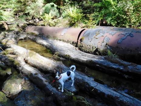
Spot is an expert at these river crossings, well practiced in keeping his paws dry. These huge iron pipes used to form an immense culvert.
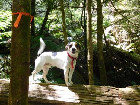
He loves to lead the way; having a good time, I'd say! We are marking the track with tape as we go.
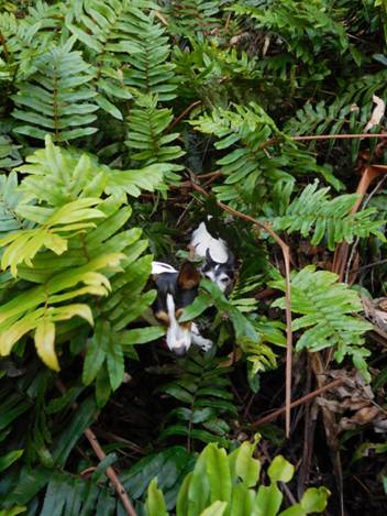
Sometimes it is hard going for the dogs (as well as the people)! This herringbone fern is particularly awkward to navigate.
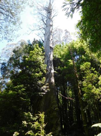
Sometimes you come across the ruins of a forest giant. Who knows how tall this one was before its top broke off? Remember, these were the world's largest trees - up to 120 metres tall!
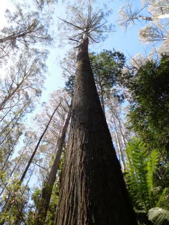
This younger tree is vying for the record.
It has come up right next to the stump of its parent tree. The younger tree is more than 3 metres diameter at its base; The stump larger still.
It was quite a substantial road once. This cutting is over 5 metres deep. 2-3 semis could easily pass on it. Such a pity such tracks were not retained for land management and recreational purposes.
Tiny just can't help but drink from every deer wallow! There was plenty of good deer sign, but the area must be well-nigh impossible to hunt.
Everywhere along the way are scenes of great beauty.
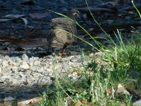
And interesting wildlife: this pigeon was almost as tame as Della's! Gippsland is wonderful!
Unfortunately we made it only about half way to the top. We may try
coming down from
Even though the forecast was for 35C yesterday, at Mt Baw Baw and Tanjil Bren it only reached 21C! 14 degrees difference! We are so lucky to have these mountain areas (relatively) so close by. Wonderful for cool summer hikes. The Upper Yarra Track traverses the outstanding Baw Baw Plateau with many camping and scenic attractions. The Mt Darling- Snowy Bluff wilderness is also only a couple of hours away and (also) being around 1.5km in elevation is much cooler in the summer months. Of course, check the weather outlook. It can snow at any time of the year at these elevations - and there is always the risk of bushfire in very dry conditions. After rain is always nice, as everything will be cool and freshened up.
See also: http://www.theultralighthiker.com/spots-hunting-adventures-1-mystery-river/
http://www.theultralighthiker.com/not-quite-alone-in-the-wilderness/
http://www.theultralighthiker.com/camping-by-the-moroka-river/
http://www.theultralighthiker.com/snowy-bluff-mt-darling-wilderness/
http://www.finnsheep.com/THE%20UPPER%20YARRA%20WALKING%20TRACK.htm
http://www.theultralighthiker.com/upper-yarra-track-update-section-one-moe-yallourn-rail-trail/